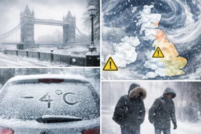
Snow forecast conditions across the UK remain a key concern heading into Saturday, 22 February, as a lingering cold snap continues to interact with unsettled Atlantic weather systems. Forecast models indicate a complex weather pattern, with cold air holding on across parts of northern and central Britain while milder, wetter air pushes in from the south-west. As a result, several regions remain vulnerable to snow, sleet, heavy rain and travel disruption, particularly where temperatures sit close to freezing. Uncertainty remains high over the precise boundary between rain and snow, raising the risk of rapidly changing conditions at a local level. According to The WP Times newsroom, citing the latest guidance from Met Office, this forecast outlines where snow is most likely to fall, whether London faces any wintry risk, and which parts of the UK could see the most significant weather-related impacts.
UK weather pattern on Saturday, 22 February
The broader UK snow forecast for Saturday reflects a transitional weather setup rather than a clear-cut cold outbreak. Cold air remains entrenched across parts of northern and central Britain following several nights of frost, while frontal systems moving in from the south-west introduce cloud, rain and stronger winds.
During the early hours of Saturday, many inland areas are expected to start below or close to freezing, especially across northern England, Wales and Scotland. This creates conditions where precipitation arriving later in the day may initially fall as snow over higher ground before turning increasingly to rain as temperatures slowly rise.
Daytime temperatures will vary considerably by region. Northern and central parts of the UK are likely to see maximum values of 3–6°C, while southern England, including London, may reach 7–9°C during the afternoon. However, these slightly higher values will do little to offset the raw feel caused by cloud cover and wind.
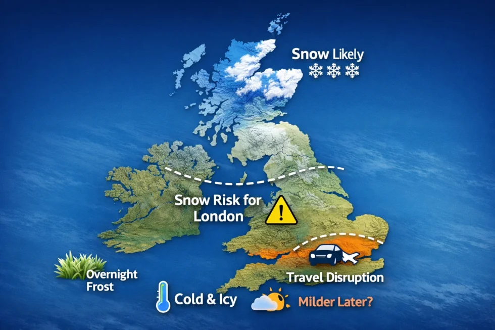
Where is snow expected to fall
Snowfall on Saturday is expected to be unevenly distributed, with altitude playing a decisive role. While widespread heavy snow at low levels is not currently forecast, several regions remain at risk of accumulating snow, particularly above 150–200 metres. The areas with the highest likelihood of snow include:
- Mid and south Wales, especially upland areas where cold air is slow to retreat
- The Midlands, notably higher ground in Herefordshire, Shropshire and parts of Staffordshire
- Northern England, including the southern Pennines and elevated sections of the Peak District
- Scotland, mainly central and eastern high ground, where colder air is more persistent
In these locations, snowfall accumulations of 2–5 centimetres are possible, with locally higher totals on the highest hills. In contrast, lower-lying areas are more likely to experience rain or sleet, although brief spells of wet snow cannot be ruled out during heavier bursts of precipitation.
London snow forecast: will it snow in the capital
For London, the snow risk on Saturday, 22 February remains low but not entirely absent. Forecast models suggest that the capital will sit close to the boundary between colder inland air and slightly milder air pushing up from the south. Early Saturday morning in London is expected to be cold and cloudy, with temperatures around 3–4°C. As rain spreads eastwards later in the morning or early afternoon, surface temperatures should be just high enough for precipitation to fall predominantly as rain.
However, during periods of heavier rainfall, especially in outer London, north London and parts of Greater London, there is a small chance that rain could briefly mix with sleet or wet snow. Any such wintry precipitation is expected to be short-lived, with little or no accumulation on roads, pavements or transport infrastructure. The greater concern for London is not snow but persistent rain, poor visibility and a damp, chilly feel throughout the day. These conditions may still impact travel, particularly during busy weekend periods.
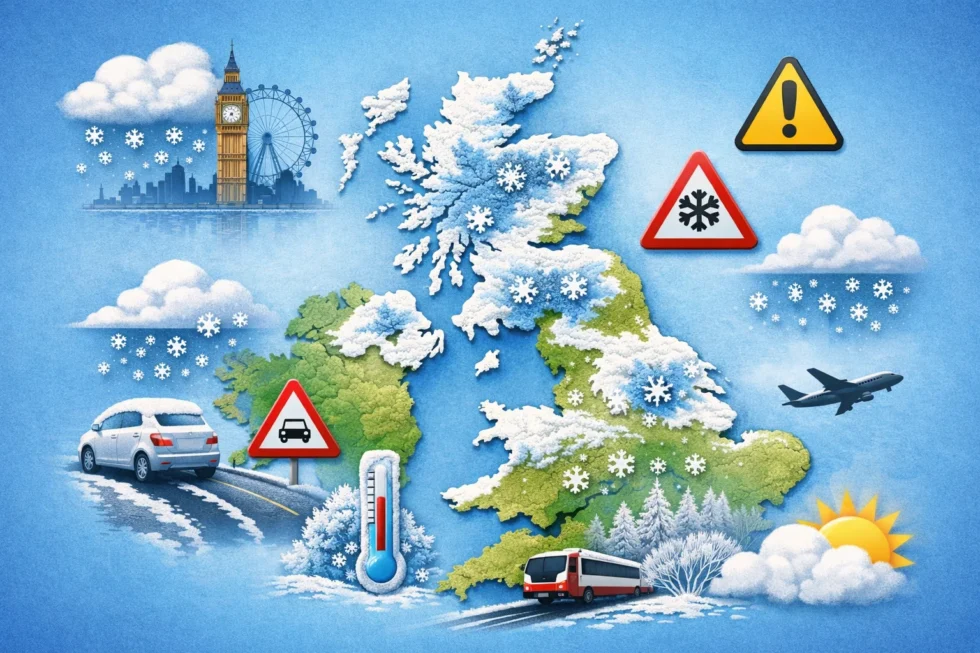
UK weather warnings and potential impacts
UK weather warnings remain in force for parts of the country as the cold snap continues. While not all regions are affected equally, the warnings highlight the potential for disruption where snow, rain and wind overlap. Key risks highlighted for Saturday include:
- Snow and ice on higher routes across Wales, the Midlands and northern England
- Heavy rain across southern England, raising the risk of surface water flooding
- Strong winds, increasing hazards for high-sided vehicles and exposed transport routes
Drivers travelling through upland areas are advised to check conditions carefully, as road conditions may deteriorate rapidly during periods of snowfall or freezing temperatures overnight.
Rain and flooding risk in southern England
While snow attracts much of the attention, heavy rain poses a more widespread threat across parts of southern England. Several regions have already experienced prolonged wet conditions earlier in the year, leaving ground saturated and rivers running high. On Saturday, further rainfall could lead to:
- Localised flooding of roads and low-lying land
- Delays and disruption to road and rail services
- Rising river levels, particularly in catchments already under pressure
Even modest additional rainfall may exacerbate existing flooding problems, especially where drainage systems are already stretched.
emperature trends and overnight frost
Although the coldest conditions of the week are expected to gradually ease, Saturday night may still bring frost to many inland areas, particularly where skies clear and winds drop. Residual cold air remains in place across large parts of the country, allowing temperatures to fall quickly after sunset, especially away from coastal and urban influences.
Temperatures overnight into Sunday morning could fall close to or below freezing across parts of northern England, Wales and Scotland. Even locations that experience rain during the daytime may still see icy patches develop overnight as surface water freezes. This creates a renewed risk on untreated roads, pavements and rural routes, particularly during the early hours of Sunday. Health authorities continue to monitor the effects of the cold spell. Previous alerts from the UK Health Security Agencyhave highlighted how prolonged cold weather can place additional strain on healthcare and social care services, with older people and those with existing health conditions facing the highest risk during overnight temperature drops.
Expected overnight temperatures and frost risk (Saturday night into Sunday)
| Region | Expected overnight low | Frost risk | Key impacts |
|---|---|---|---|
| Northern England | 0°C to -3°C | High | Icy patches on rural roads, untreated pavements, local travel disruption |
| Wales (inland & upland) | -1°C to -4°C | High | Increased risk of black ice, hazardous early-morning driving conditions |
| Scotland (central & eastern) | -2°C to -6°C | Very high | Widespread frost, icy surfaces, continued cold stress overnight |
| Midlands | 0°C to -2°C | Moderate | Patchy frost, especially where skies clear overnight |
| Southern England (excluding London) | 1°C to -1°C | Low to moderate | Localised frost in rural areas, mainly early morning |
| London | 2°C to 4°C | Low | Little frost expected; damp surfaces may still feel icy in shaded areas |
The table highlights how frost risk remains uneven across the UK, with the most severe conditions expected away from southern coastal areas and major urban centres. While London is likely to avoid widespread frost due to residual cloud cover and urban heat effects, surrounding rural parts of southern England may still see brief freezing conditions before sunrise. From a practical perspective, motorists and pedestrians are advised to remain cautious during the early hours of Sunday, even in areas that appear wet rather than wintry on Saturday afternoon. Small drops in temperature can be enough to create hazardous conditions, particularly on bridges, elevated roads and untreated surfaces.
Travel advice for Saturday
Anyone planning to travel across the UK on Saturday should remain alert to rapidly changing weather conditions, as a combination of lingering cold air, rain and localised snowfall continues to affect parts of the country. While conditions will vary significantly by region, several common risk factors are expected to influence travel throughout the day and into the night.
The most challenging conditions are likely to be encountered on upland routes, where snowfall may accumulate and surface temperatures remain low enough for snow or ice to persist. Even modest snowfall in these areas can lead to reduced visibility, hazardous driving conditions and temporary road closures. Travel conditions may also deteriorate during the evening and overnight period, when temperatures fall and any residual moisture on roads and pavements begins to freeze. This raises the risk of black ice, particularly on untreated roads, bridges and elevated sections of the network.
In flood-prone areas of southern England, persistent or heavy rain may continue to disrupt journeys. Localised flooding, standing water and spray can significantly slow traffic and increase the risk of incidents, especially on rural roads and low-lying routes. Rail passengers should also be prepared for delays and disruption, particularly on services crossing higher ground or regions affected by heavy rainfall. Reduced speeds, signalling issues and waterlogged tracks remain possible where weather conditions worsen.
When will the weather improve
Looking ahead, forecasts indicate a gradual transition to milder air during Sunday and into early next week as Atlantic systems become more dominant. This shift is expected to reduce the likelihood of snow at lower elevations, although unsettled conditions are likely to persist for many areas. Further bands of rain are expected to move through western parts of the UK, while eastern regions may experience more variable conditions with occasional brighter spells. Temperatures are forecast to recover closer to seasonal averages, and in some sheltered southern locations could briefly reach the low teens Celsius during periods of sunshine.
What remains uncertain in the snow forecast
Despite increasing confidence in the overall trend towards milder conditions, key uncertainties remain in the short-term snow forecast. As is often the case in marginal winter setups, small changes in temperature, wind direction or precipitation intensity could significantly alter outcomes at a local level. The exact position of the rain–snow boundary remains particularly sensitive across parts of central Britain, where slight variations could determine whether precipitation falls as rain, sleet or snow. Timing also remains critical, especially during the evening and overnight hours when temperatures fall most sharply. For this reason, updated forecasts and weather warnings from the Met Office remain essential for anyone planning travel or outdoor activities on Saturday, as conditions may evolve with little notice.
Read about the life of Westminster and Pimlico district, London and the world. 24/7 news with fresh and useful updates on culture, business, technology and city life: UK inflation falls to 3% in January 2026 as Bank of England rate cut expectations surge