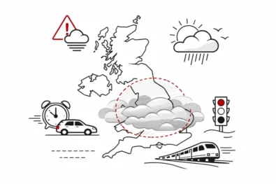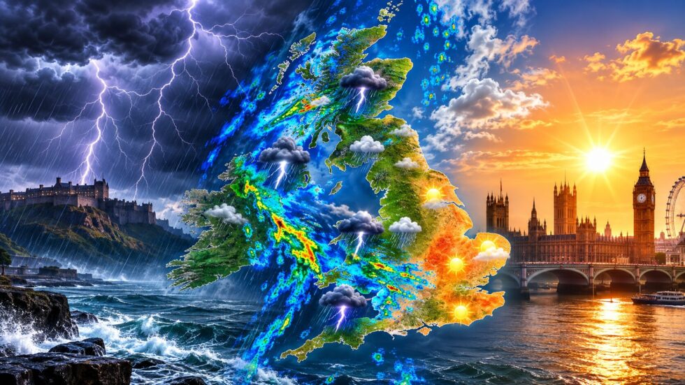
UK weather heatwave thunderstorms are dividing Britain sharply on Tuesday, 4 August, with yellow warnings for potentially disruptive storms across Northern Ireland and large parts of Scotland while eastern and south-east England remain very warm, humid and mostly dry. The Met Office says persistent rain in northern Britain could turn heavy, with hail, lightning and sudden surface-water flooding possible, but London and much of the South East are expected to reach about 28C before fresher air spreads more widely from Wednesday. The WP Times reports that this is not a nationwide wall of rain ending the heatwave at once, but an uneven transition in which the wettest places may face intense downpours while some of the country’s driest areas receive little useful rainfall.
Three Met Office thunderstorm warnings are in effect: one for Northern Ireland on Tuesday, another covering parts of central and southern Scotland on Tuesday, and a further warning for northern Scotland on Wednesday. Amber heat-health alerts meanwhile remain active until 9am on Wednesday for the East Midlands, East of England, South East and London, with yellow alerts across several other English regions. The contrast follows an exceptional July in which provisional Met Office figures showed England and Wales heading towards their driest July on record, leaving fields, gardens and water supplies under pressure even as localised storms create a short-term flash-flood risk.
UK weather heatwave thunderstorms: where are the Met Office warnings
The most immediate severe-weather risk on Tuesday is concentrated in Northern Ireland and Scotland rather than across the whole of England and Wales. A yellow thunderstorm warning for all six counties of Northern Ireland runs from 9.15am until 9pm, with the Met Office warning that heavy showers and thunderstorms could disrupt travel, outdoor events and power supplies. The warning area includes counties Antrim, Armagh, Down, Fermanagh, Londonderry and Tyrone.
A separate yellow thunderstorm warning covers Central, Tayside and Fife, Grampian, Strathclyde, south-west Scotland and the Lothian and Borders region during Tuesday. Another warning remains in place for Wednesday across Central, Tayside and Fife, Grampian and the Highlands and Eilean Siar. These warning zones reflect the expected position of the most unstable air and persistent rain rather than a prediction that every town inside them will experience a thunderstorm.
The principal hazards are:
- sudden heavy rain falling over a short period;
- spray and standing water on roads;
- local flash flooding of homes, businesses and low-lying routes;
- hail reducing visibility and making roads slippery;
- lightning strikes damaging buildings or electrical systems;
- short interruptions to power and mobile services;
- delays to buses, trains, ferries and flights;
- disruption to festivals, sports fixtures and other outdoor events.
The Met Office says some flooding of homes and businesses is likely in the Northern Ireland warning area. Drivers could face longer journey times because of spray, surface water or hail, while train delays are also possible. The agency advises people to check whether their home or journey is vulnerable to flash flooding and to keep travel plans under review because thunderstorm warnings can change quickly.
Why thunderstorms can be severe but highly localised
Thunderstorms do not distribute rainfall evenly. One neighbourhood can receive an intense downpour while another only a few miles away remains almost dry. That is particularly important during a drought because dramatic radar images or flooded streets do not necessarily mean reservoirs, rivers and agricultural soils have received enough sustained rainfall to recover. Heavy summer rain may fall faster than hard, dry ground can absorb it. Water then runs across roads, pavements and fields into drains and low points, creating flash flooding even where the wider region remains short of water. Built-up areas are especially vulnerable because concrete and tarmac leave less ground available to absorb rainfall.
This explains the apparently contradictory forecast: parts of Britain face flooding from thunderstorms, yet the places most affected by drought may receive only scattered showers or no meaningful rain at all. The Met Office national forecast says the heaviest and most persistent rain will remain in northern areas, while eastern and south-eastern England stay largely dry and humid.
Met Office weather forecast: what will happen across the UK today
The national picture on Tuesday is split between a wet and unstable north and a warmer, brighter south and east. Persistent rain is forecast across northern Britain, becoming heavy in places, while Northern Ireland has the clearest risk of hail and thunder. Western parts of England and Wales may see scattered showers, but these are expected to be less organised and less widespread. Eastern England will hold on to very warm and humid conditions for most of the day. London and the South East are forecast to remain mainly dry, with sunny spells turning hazier during the afternoon and only a limited chance of an isolated shower. The Met Office gives a maximum temperature of 28C for the London and South East region, followed by a warm night with temperatures falling no lower than about 17C in some places.
| UK area | Tuesday, 4 August outlook | Main risk |
|---|---|---|
| Northern Ireland | Heavy showers and thunderstorms | Flash flooding, hail, lightning and travel disruption |
| Central and southern Scotland | Persistent rain with thunderstorms possible | Surface water, difficult driving and local flooding |
| Northern Scotland | Wet and unsettled, with warnings continuing into Wednesday | Prolonged rain and transport disruption |
| North-west England | Cloudier with rain or showers nearby | Local heavy bursts and standing water |
| Wales | Scattered showers, especially farther west | Brief heavy rain but uneven totals |
| Midlands | Warm and humid, with isolated showers possible | Heat stress and limited local downpours |
| London and South East | Mostly dry, sunny and humid, near 28C | Heat-health impacts and a warm night |
| South-west England | Some showers but not a complete break in the dry pattern | Local rain with continuing water stress |
The weather will remain changeable overnight. Rain is likely to continue across northern areas, with scattered showers elsewhere. Eastern and south-eastern England should remain mostly dry, and another warm night is expected before a more noticeable cooling trend develops on Wednesday.
Wednesday will still bring showers or longer periods of rain to northern Britain, including a continuing risk of hail and thunder. Elsewhere, sunny spells should develop, but stronger winds and a shift in the air mass will make conditions feel cooler than during the peak of the heatwave.
Is the UK heatwave ending everywhere?
Not immediately and not uniformly. The arrival of rain and lower pressure is ending the most intense heat in some areas, but the hottest air is proving slower to leave eastern and south-east England. Tuesday therefore remains very warm and humid in the east, even while Scotland and Northern Ireland experience heavy rain.
The change becomes clearer from Wednesday, when temperatures are expected to move closer to seasonal norms and breezier conditions spread. London and the South East are forecast to reach about 25C on Wednesday, compared with roughly 28C on Tuesday. By Thursday to Saturday, the Met Office expects a mixture of sunny spells and scattered showers, with a much cooler feel than during the recent heat.
That does not rule out further hot weather later in August. The Met Office long-range outlook says temperatures will probably remain above average overall, particularly in the south, and further heatwaves are possible later in the month. It also warns of occasional thundery interludes, meaning Britain could see further abrupt transitions between heat, humidity and localised heavy rain.
Flash flood risk after the driest July on record
The thunderstorm threat arrives after a month of exceptional dryness. Provisional Met Office data to 30 July showed England had received only 5.6mm of rain, equivalent to 8 per cent of its long-term July average. That was less than half the previous July record low of 13.4mm, set in 1911. Wales recorded 7.9mm, also about 8 per cent of its average and roughly one-third of its previous record low. Southern England received just 1.5mm during the period, equivalent to 2 per cent of the normal monthly total. Across the whole UK, rainfall stood at only 35 per cent of average, placing July on course to be the country’s third driest July and the driest nationally since 1868. The rainfall deficit was accompanied by exceptional warmth and sunshine:
- England was tracking its joint warmest July on record for mean temperature;
- Wales was tracking its warmest July on record;
- the UK was tracking its second warmest July;
- southern England’s mean temperature stood 3.2C above average;
- England and Wales were each tracking their second sunniest July;
- the UK was tracking its fourth sunniest July since sunshine records began in 1910.
“Across parts of England and Wales we’ve seen extraordinarily low totals, with some locations recording little or no meaningful rainfall for much of the month,” Met Office scientist Dr Emily Carlisle said when the provisional figures were released. She added that the emerging rainfall totals were particularly significant when considered alongside the exceptional heat experienced during the summer.
Why one day of storms will not resolve the drought
A drought is built over weeks or months and cannot normally be reversed by a few hours of rain. Sustained, moderate rainfall is more useful for replenishing soil moisture, rivers and reservoirs than a short cloudburst that rapidly runs into drains or causes flooding.
Much of Tuesday’s rain is also expected in northern and western parts of the UK, while the deepest rainfall deficits are concentrated across England and Wales, particularly southern England. London, the South East and parts of the East of England may remain mostly dry during the transition, despite experiencing some of the greatest heat and water stress.
Rainfall totals under thunderstorms are inherently uneven. A warning indicates a risk of severe impacts somewhere inside the designated area, not continuous heavy rain across every location. Farmers, water companies and households should therefore not interpret the storm forecast as evidence that restrictions or drought pressures are about to disappear.
UK heat-health alerts remain in force despite the rain
The UK Health Security Agency has amber heat-health alerts in place for the East Midlands, East of England, South East and London until 9am on Wednesday, 5 August. Yellow alerts cover the North West, South West, West Midlands and Yorkshire and the Humber, while the North East has no alert.
Heat-health alerts are separate from Met Office weather warnings. A thunderstorm warning addresses immediate hazards such as lightning, flooding and transport disruption. A heat-health alert assesses the likely effect of high temperatures on hospitals, care services and vulnerable people.
Under an amber alert, health authorities consider significant impacts across health and social care to be likely. These may include increased deaths among older people and those with existing medical conditions, greater demand for NHS and care services, overheating in hospitals and care homes, difficulties managing medicines and pressure on staff and power supplies.
People at greater risk include:
- adults aged 65 and over;
- babies and young children;
- people with heart, lung or kidney conditions;
- people taking medicines that affect hydration or temperature control;
- those living alone or in overheated homes;
- outdoor workers;
- people sleeping rough;
- anyone undertaking strenuous exercise during the hottest part of the day.
Residents in hot regions should continue to drink regularly, close curtains on sun-facing windows, ventilate homes when the outside temperature falls and check on vulnerable relatives or neighbours. The arrival of cloud or a nearby shower does not immediately remove heat stress, particularly after several hot days and warm nights.
What should drivers and rail passengers do during thunderstorms
The greatest travel risk comes from sudden changes in road conditions. A dry road can become covered by standing water within minutes during an intense downpour. Hail may further reduce grip and visibility, while lightning or local flooding can damage signals, power systems and rail infrastructure. Drivers in warning areas should reduce speed, increase the distance from the vehicle ahead and avoid attempting to cross floodwater. Even shallow-looking water can conceal damaged road surfaces, displaced drain covers or a stronger current than expected. Journey times should be checked before departure, particularly across Northern Ireland and Scotland.
Rail passengers should monitor live service information because speed restrictions or signal failures can cause delays even after the heaviest rain has passed. Travellers heading to airports, ferry ports or outdoor events should allow additional time and consider whether routes cross low-lying or flood-prone roads. The Met Office also advises anyone who hears thunder outdoors to move into a secure enclosed building or vehicle. Trees, temporary shelters, hilltops and exposed open ground do not provide safe protection from lightning.
What will the UK weather do after the heatwave and thunderstorms
From Thursday to Saturday, the Met Office expects a mixed but generally cooler pattern. Sunny spells will alternate with scattered showers, and breezier conditions will make temperatures feel markedly fresher than during the heatwave. Scotland may continue to see more frequent rain, while southern Britain should experience longer dry intervals. The outlook from 8 to 17 August remains changeable. Rain or showers are possible, but southern areas are also likely to have useful dry spells. High pressure may strengthen to the north or north-west around the middle of August, while lower pressure near southern or eastern Britain could produce further thundery episodes.
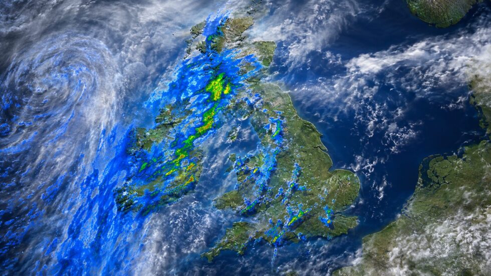
Rainfall will therefore remain highly variable. Some locations may receive substantial totals from showers, while nearby areas continue to record very little. Temperatures are expected to remain above average in many southern areas, although the Met Office does not currently expect the same exceptional heat to dominate every day. For the second half of August, the broad signal continues to favour high pressure near the UK, interrupted by Atlantic fronts or thundery plumes. Further hot spells or heatwaves remain possible, particularly in southern England, but confidence in the timing and location of individual episodes will remain limited until closer to the date.
UK weather heatwave thunderstorms: the essential forecast
Tuesday’s forecast is best understood as two overlapping weather stories. Northern Ireland and Scotland face a genuine risk of disruptive thunderstorms, heavy rain, hail and local flash flooding. Eastern and south-east England, by contrast, remain mostly dry, humid and hot enough for heat-health alerts to stay in force. The rain marks the beginning of a cooler and more changeable phase, but it will not provide a nationwide end to the rainfall deficit. The regions most in need of prolonged rain may miss the heaviest downpours, while places receiving intense storms could experience flooding without gaining the slow, sustained replenishment required after an exceptionally dry July.
Residents should follow official local warnings rather than relying on national headlines or individual weather-model maps. Thunderstorm forecasts can shift within hours, and conditions may vary sharply over short distances. The decisive change for most of the country will be the arrival of cooler, breezier air from Wednesday, although further hot and thundery episodes remain possible later in August.
Materials used: Met Office national forecast, Met Office UK weather warnings, Met Office July 2026 climate statistics, UK Health Security Agency heat-health alerts, Met Office London and South East forecast.
Read about the life of Westminster and Pimlico district, London and the world. 24/7 news with fresh and useful updates on culture, business, technology and city life: What is known about the August England bus pass change and who will have to wait longer to qualify