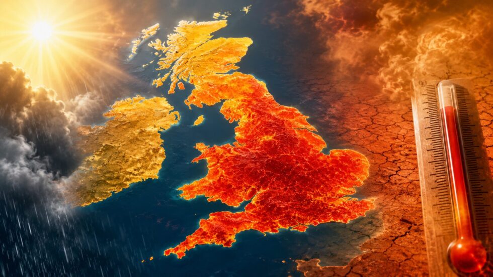
Britain is poised to swing abruptly from a cooler, unsettled weekend back into intense summer heat, with temperatures potentially reaching 35C next week and raising the prospect of the UK’s fourth heatwave of an already record-breaking year. The renewed surge is expected to affect large parts of England and Wales after only a brief respite, while drought conditions deepen, hosepipe restrictions affect millions of households and firefighters continue to tackle a major wildfire emergency in the Scottish Highlands, The WP Times editorial team reports.
Forecasts indicate that the heat will intensify and spread from the beginning of next week, with the highest temperatures most likely across southern, central and eastern England and parts of Wales. Some areas could meet official heatwave thresholds for several consecutive days, although the designation will depend on how widely the extreme temperatures develop and how long they persist. The widely cited 35C peak remains possible rather than certain, with forecasters still assessing the precise position of the hottest air and the influence of cloud, wind and any isolated thunderstorms.
This Westminster Pimlico News guide explains what to expect during the final days of July and the opening days of August, including when the heat is likely to peak, which regions face the highest temperatures and how confident forecasters are in the most extreme projections. It also examines the wider consequences of another prolonged hot spell, from water shortages and hosepipe bans to elevated wildfire danger, transport disruption and increased health risks for vulnerable people. The outlook is broken down by region and by day, with clear answers to the main questions facing households, commuters and travellers.
At a Glance: The Week Ahead
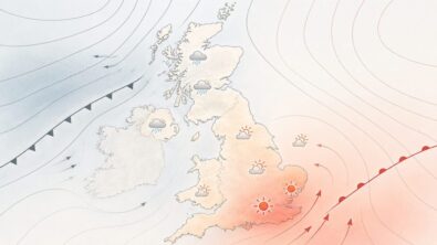
- Weekend (26–27 July): Cooler and more unsettled, with rain in the north and north-west and scattered showers elsewhere. Highs widely 20–25C. Even the stubborn local heatwaves are expected to break.
- Early next week (28–29 July): High pressure rebuilds close to southern Britain. Heat returns first to central and eastern England.
- Midweek peak (30 July): The hottest day, with widespread low-30s across England and Wales and the small chance of a locally higher spike.
- End of the week and next weekend: Very warm and largely settled in the south; some models flag a more intense surge that could flirt with 35C in east Wales and much of England.
- Into August: Temperatures likely to stay above average in the south, hovering around or just below heatwave thresholds.
Weekend Respite, Then the Heat Comes Roaring Back
The immediate picture is a genuine, if short-lived, cooldown. Following welcome rain in the north and north-west of the UK over the weekend, temperatures dip and the pressure eases. As temperatures fall further over the weekend and parts of the country see a little rain, even the most stubborn local heatwaves are likely to come to an end.
But that reprieve won't last. Next week, high pressure is forecast to build close to the south of the UK, meaning rain-bearing weather fronts stall and lose their grip. Any wet weather becomes increasingly confined to northern and western areas — especially north-west Scotland — while across southern Britain temperatures climb once again. It is a familiar pattern for the summer of 2026: a dominant "blocking" high that parks warm, dry air over the country and pushes the Atlantic's rain-bearing systems out to the margins.
The result is a marked north-south split. The south bakes; the far north and west stay fresher, cloudier and wetter. It is this same split that has defined week after week of an extraordinary British summer.
Two Places That Never Cooled Down
For all the talk of a "break," two locations have barely paused for breath. Temperatures at Usk in Monmouthshire and Exeter in Devon reached heatwave thresholds for the 20th consecutive day on Friday — the longest such run anywhere in the UK so far this year. While most of England and Wales dropped out of the third heatwave last weekend as cooler air arrived and knocked maximum temperatures down to 20–24C, these two spots kept nudging over the line day after day. As the weekend's cooler air spreads, even Usk and Exeter are finally expected to fall below their thresholds — but perhaps only briefly.
When Is a Heatwave Officially Declared
This is the single most misunderstood point in British weather coverage, so it is worth setting out clearly.
A UK heatwave is declared when the daily maximum temperature meets or exceeds a set threshold for three consecutive days. Crucially, that threshold is not the same everywhere. It varies by region, reflecting what is genuinely unusual for each part of the country:
- 25C across much of the north and west of the UK.
- Up to 28C in parts of eastern and south-eastern England, where hot spells are more common.
Those thresholds were widely met in late May, again in June, and again in July — which is why the UK has already recorded three heatwaves this year. A fourth is now a real possibility.
But there is an important caveat. A handful of hot stations does not make a national heatwave. As the Met Office puts it, if only one or two stations reach heatwave criteria, that would not be defined as a heatwave. In other words, the heat has to be both hot enough and widespread enough for long enough. That is precisely the question hanging over next week.
Region-by-Region Forecast: Late July into Early August
The table below sets out the expected pattern as the heat rebuilds through the coming week. The hottest conditions focus first on central and eastern England before spreading north and west; Scotland and Northern Ireland stay cooler for longer but warm up towards the following weekend.
| Region | Conditions | Daytime highs | Notes |
|---|---|---|---|
| London & South East | Hot, dry, high pressure building | 30–33C | Heatwave threshold (28C) likely to be met; up to 35C possible next weekend on some models |
| Central England | Hottest zone early in the week | 30–35C | Peak around Wednesday; watch Midlands stations |
| East England & East Anglia | Very warm, sunny, dry | 30–34C | Initial focus of the heat by Tuesday |
| South West England | Warm, largely dry, sunny spells | 28–33C | Exeter among the longest local heatwave runs of 2026 |
| East Wales | Hot inland; severe drought risk | 30–35C | North Wales already in official drought status |
| West Wales | Warm and dry; elevated wildfire risk | 27–31C | Welsh Government crisis measures active |
| North England | Warmer later in the week as heat spreads | 24–30C | Rises from midweek onwards |
| Scotland | Coolest; wetter north-west; wildfire emergency | 18–26C | Mid-to-high 20s possible by next weekend |
| Northern Ireland | Near seasonal average, warming later | 20–26C | High teens to mid-20s |
Figures are indicative daytime highs under the prevailing high-pressure pattern. Localised variation applies, and confidence in the 35C ceiling is lower than for the 30–32C range. Always check your local forecast for day-specific detail.
Day-by-Day: How the Heat Builds
While the regional table gives the shape of the week, here is how the heat is expected to evolve through the days for southern and central Britain — the areas set to feel it most.
Saturday 26 July. A cooler, fresher day for most. A mix of sunny spells and showers, some heavy at times, particularly in the north and west. Often breezy, if not windy, around exposed coasts. Highs widely in the low 20s, closer to the seasonal average.
Sunday 27 July. Similar — sunshine and showers, cooler than of late, highs around 25C in the warmest southern spots. This is the low point of the temperature dip.
Monday 28 July. High pressure begins to reassert itself. Dry and brightening from the south, temperatures starting to nudge upwards. Central and eastern England lead the recovery.
Tuesday 29 July. The heat becomes established. Central and eastern England see the first of the hot days, with highs into the low 30s. Sunny and dry for most; the north and west hold onto more cloud and the odd shower.
Wednesday 30 July. The expected peak of the spell. Widespread low-30s across England and Wales, with the hottest stations potentially higher still. Long spells of strong late-July sunshine and very high UV.
Thursday–Friday 31 July–1 August. Very warm and largely dry continues in the south, with sunny spells persisting. A small risk of isolated thunderstorms breaking out, particularly across the south and south-west, where they can be sharp — bringing lightning, sudden downpours and brief travel disruption before the warmth reasserts.
Next weekend (2–3 August). The wildcard. Some computer models suggest an even more intense surge of heat could arrive, with east Wales and most of England potentially seeing 30–35C. Scotland and Northern Ireland warm up too, into the mid-to-high 20s.
How Hot, and How Confident? The 35C Question
The 35C headline is the one grabbing attention, and it deserves proper context rather than breathless repetition.
For much of next week, temperatures across England and Wales are expected to peak around 25–32C, with the hottest weather focusing initially on central and eastern England by Tuesday before spreading northwards and westwards. The peak is expected around Wednesday, with sunny, warm conditions persisting into Friday.
The higher figures come with a clear health warning attached. Met Office operational meteorologist Niamh Murray explained the spread between the models plainly. Some models, she said, are showing the mid-30s heading into next week; however, the current central expectation is for temperatures between 30C and potentially 32C. "We're not going for 35C," she said, "but, given the timeframe, there is scope for that to be supported by other models."
In plain terms: 30–32C is the confident forecast; 35C is a plausible upper edge that a minority of models are flagging, most likely for the following weekend rather than the early part of the week. Readers planning outdoor events, travel or work should plan around the low-30s as the working assumption, while keeping an eye on updates for any upgrade towards the mid-30s.
Meanwhile Scotland and Northern Ireland stay cooler throughout, with temperatures generally in the high teens or low-to-mid twenties before edging into the mid-to-high 20s later in the spell.
The Bigger Picture: A Record-Breaking Year
Next week's heat, however it plays out, sits within a genuinely historic run. The summer of 2026 has already delivered a string of remarkable milestones that put the coming spell in perspective.
For the first time in the UK weather record, temperatures of 35C or higher have been recorded in May, June and July of the same year. The country has logged a record number of days above 34C, surpassing benchmarks that had stood since the notorious summers of 1976 and 2020. Late June brought record-breaking heat across parts of the UK and Europe — heat severe enough to disrupt trains, close schools and stretch emergency services — with a study estimating that at least 2,700 people may have died in England and Wales as a result of the May and June heatwaves.
Against that backdrop, a spell topping out around 30–32C would, extraordinarily, count as relatively unremarkable for 2026. That in itself tells the story of the summer.
Why Is It So Hot? The Weather Pattern and the Climate Signal
Two things explain next week's heat: the immediate weather pattern, and the longer-term warming trend underneath it.
The immediate driver is a blocking area of high pressure. Under a high, air sinks, cloud struggles to form, and long hours of strong late-July sunshine heat the ground day after day. Because the high is expected to sit close to southern Britain, it deflects the Atlantic's rain-bearing weather fronts to the north and west, which is why Scotland and Northern Ireland stay cooler and wetter while the south bakes. Blocking highs are also self-reinforcing in a dry landscape: with soils parched and little moisture to evaporate, more of the sun's energy goes into heating the air rather than drying the ground, nudging temperatures higher still.
But the backdrop matters just as much as the pattern. Scientists are increasingly clear that human-caused climate change is loading the dice towards exactly this kind of summer. Following the May and June heatwaves, a rapid attribution analysis by Imperial College London, the London School of Hygiene and Tropical Medicine and the Met Office concluded that climate change made the heat significantly more intense and more deadly — estimating that a large share of the excess deaths were directly attributable to human-driven warming. Daytime maximum temperatures across England and Wales now run several degrees above their pre-industrial equivalent.
Dr Mark McCarthy, who manages climate attribution at the Met Office, described 2026 as exceptional in particular for its two early-season heatwaves in May and June — months that historically would have required no heat-emergency planning at all. Researchers have been blunt about what it means. Every fraction of a degree of warming, they warn, brings more hospital admissions and more heat deaths, and record-breaking heat is now arriving earlier in the year than Britain's infrastructure and health systems were ever designed for. Their message is a dual one: adapt now to the climate the UK already has, and cut emissions to stop it worsening.
For readers, the practical takeaway is simple. Spells like next week's are no longer freak events to be endured once a decade; they are becoming a recurring feature of the British summer, and planning for them — at home, at work and across public services — is now part of normal life.
When Extreme Heat Meets Ageing Infrastructure
One of the hardest lessons of 2026 has been how poorly a country built for a temperate climate copes with sustained extreme heat. Next week's spell, while not expected to reach the exceptional peaks of earlier in the summer, is a reminder of the strain that hot weather places on everyday systems.
On the railways, steel rails can buckle when rail-surface temperatures approach the mid-40s Celsius — achievable when air temperatures top 30C in direct sunshine. To prevent derailments, Network Rail imposes speed restrictions, which in turn cascade delays across an already capacity-constrained network. Earlier this summer, heat-related speed restrictions, signalling faults and track defects disrupted services on multiple major routes, with buckled rails forcing outright suspensions on some lines. Passengers travelling during next week's peak should build in extra time and check before they set off.
On the roads, high asphalt temperatures contribute to a spike in vehicle breakdowns, with patrol services reporting demand well above normal during the hottest spells. Overheating engines, stressed tyres and softened road surfaces all take their toll, congesting key routes and freight corridors.
On the health service, the toll is measured in lives. The May and June heatwaves alone were estimated to have caused more than 2,700 excess deaths in England and Wales, placing intense pressure on the NHS and social care. People aged 85 and over bear a strikingly large share of heat-related deaths, partly because older adults commonly underestimate their own risk. That is why daily social contact — a simple phone call or knock on the door to an elderly relative or neighbour — is itself a proven, mortality-reducing intervention during any heat-health alert.
On local services, councils draw on emergency contingency funds to scale up welfare checks on vulnerable residents, while water companies juggle supply disruptions on top of the demand-driven restrictions detailed below. It all adds up to a picture of a country still adapting, often reactively, to summers it was not built for.
Drought, Hosepipe Bans and a Country Running Dry
This is no longer simply a story about sunbathing weather. The relentless dry spell is tipping swathes of the country into genuine water stress, and the practical consequences are now landing on millions of doorsteps.
The Scale of the Dry
The numbers are stark. Across England, many regions are officially in "prolonged dry weather" status — the stage immediately before drought. The National Drought Group has confirmed that vast areas, including East Anglia, the West Midlands, Devon, Cornwall and the Isles of Scilly, Lincolnshire and Northamptonshire, Hertfordshire and London, Wessex, Thames, Solent and the South Downs, now sit in that category. England has received only around 3 per cent of its average July rainfall, and reservoir storage across England stands at roughly 75 per cent — some seven percentage points below the long-term average for the time of year.
Wales has gone further. North Wales and the Upper Severn have become the first parts of the UK to officially declare drought status, after receiving less than 2 per cent of the month's expected rainfall, with low river flows across large parts of the region and some locations recording or approaching record lows. Other areas are expected to follow unless significant rain returns.
Who Is Affected by a Hosepipe Ban?
The formal name for a hosepipe ban is a Temporary Use Ban (TUB), declared by a water company under the Water Industry Act. Only water companies can declare one — not councils and not central government — and the ban follows water-supply areas rather than tidy county lines, which is why your neighbour on a different supplier can face different rules.
A wave of TUBs is now in force or imminent across England and Wales, affecting tens of millions of people:
- Thames Water — restrictions across most of Greater London, Luton, the Thames Valley, Surrey, Gloucestershire, north Wiltshire and far west Kent, affecting roughly 15 million customers.
- South East Water — in force in Kent from early July, extended from 25 July to its Sussex, Surrey, Hampshire and Berkshire supply areas. For Surrey, Hampshire and Berkshire this is the first restriction in 14 years.
- Southern Water — Hampshire and the Isle of Wight (note: Hampshire now has overlapping bans from two different suppliers covering different postcodes).
- Anglian Water — East of England.
- South West Water — mid and parts of east Devon.
- Affinity Water — central region.
- Cambridge Water — separate from Anglian.
- Welsh Water (Dŵr Cymru) — parts of west Wales, covering roughly 33,000 properties across mid and south Ceredigion, north Pembrokeshire and north Carmarthenshire; unusually, this is a demand-led ban rather than a reservoir shortage, with local treatment works unable to produce clean water fast enough to keep pace with demand running around 20 per cent above the seasonal norm.
- United Utilities — restrictions scheduled to take effect in early August.
Between them, suppliers have brought restrictions to well over 20 million people across England and Wales. Breaching a Temporary Use Ban can carry a fine of up to £1,000 per violation.
Notably, and contrary to some recycled online reports, Yorkshire Water has no 2026 restriction in place — coverage suggesting otherwise appears to be recycling bans from previous years. As ever, the reliable move is to check your own water company's postcode or supply-area checker, since the picture is moving week to week.
What a Hosepipe Ban Actually Covers
A standard TUB typically prohibits using a hosepipe to water gardens, wash cars, clean patios and windows, fill or top up swimming and paddling pools, and run ornamental fountains. Watering with a watering can or bucket is generally still permitted, as is using water for essential health, safety and hygiene purposes. Exact terms vary by company, so check the specific rules for your supplier.
Keeping a Garden Alive Under a Hosepipe Ban
For gardeners, a ban need not spell disaster. A few sensible measures go a long way:
- Water with a can, early or late. Watering at dawn or dusk cuts evaporation dramatically, so more reaches the roots. A watering can is almost always still allowed.
- Prioritise ruthlessly. Save your water for pots, new plantings, vegetables and young trees, which cannot fend for themselves. Established shrubs and lawns are far more resilient than they look.
- Let the lawn go brown. A brown lawn is dormant, not dead. Grass recovers quickly once rain returns, so there is no need to waste precious water on it.
- Mulch, mulch, mulch. A thick layer of bark, compost or even grass clippings around plants locks moisture into the soil and suppresses thirsty weeds.
- Reuse "grey" water. Cooled, uncontaminated water from washing-up bowls or baths can generally be tipped onto ornamental plants (check your supplier's terms). A water butt on a downpipe captures any rain that does fall.
- Water the soil, not the leaves. Directing water to the base of plants gets it where it is needed and reduces the risk of scorch.
Wildfire Emergency: A Major Incident in the Cairngorms
The heat and drought have combined to produce dangerous fire conditions, and the most serious response is unfolding in the Scottish Highlands.
A major incident has been declared in the Cairngorms National Park, where a wildfire first reported near Ryvoan Bothy, south of Nethy Bridge, on 15 July has continued to burn despite sustained firefighting. After more than a week, a sudden shift in weather conditions — notably strengthening winds — caused unpredictable flare-ups and pushed the fire towards properties and woodland.
Police Scotland declared the major incident and ordered the precautionary evacuation of Nethy Bridge, a village of around 600 residents, with evacuees directed to a respite centre set up at the Macdonald Aviemore Resort and access roads into the village closed. A separate small cluster of properties north-west of Dorback Lodge was also evacuated as a precaution, and a smoke advisory was issued for Tomintoul, with residents told to keep windows and doors closed. Smoke from the blaze has been visible as far away as Aberdeen, some 60 miles distant.
The response has been substantial: multiple fire appliances, specialist wildfire teams, helicopter support and a call-out for heavy plant machinery such as bulldozers to build fire breaks. The Scottish Government's Resilience Room has convened repeatedly, chaired by the First Minister, to review the position. Officials have stressed how quickly the situation can change — an overnight shift in wind direction eased the immediate threat to Nethy Bridge at one point, but residents were warned not to return until given the all-clear.
Scotland is not alone. In Wales, the government has activated "crisis management arrangements" to tackle wildfires that have broken out across the country during the recent hot, dry weather. Fire chiefs have repeatedly underlined the core message: after prolonged dry conditions, it takes only a single spark to start a wildfire, and what begins small can spread with alarming speed, threatening people, homes, wildlife and countryside alike.
Staying Safe: Heat, UV, Pollen and Water
With prolonged, intense sunshine returning, the standard hot-weather precautions matter — especially for the vulnerable.
Heat health. During previous spells this summer, the UK Health Security Agency has issued amber and yellow heat health alerts, warning of significant potential impacts on health and social care services. Older people, young children and those with underlying health conditions are most at risk. Check in on elderly or isolated neighbours, keep hydrated, avoid the midday sun where possible, and keep homes shaded and as cool as you can during the day.
UV and pollen. Under the strong late-July sun, UV levels are expected to run high or very high across much of the country — so sun cream, hats and sunglasses are essential, and it is easy to underestimate how quickly skin burns even on a breezy day. Pollen levels are also likely to be high, a factor for hay-fever sufferers.
Water safety. Hot weather draws people to rivers, lakes and the coast. Cold water shock is a genuine danger even on the hottest days, and strong winds around some southern coasts can create hazardous conditions in the sea. Take care around open water, supervise children closely, and heed local safety advice.
Wildfire awareness. In tinder-dry countryside, dispose of cigarettes responsibly, avoid barbecues and open flames in parks and open land, and report any signs of fire immediately.
What About August
The warmth looks set to linger beyond the month's end. The outlook suggests southern areas are likely to remain relatively settled and very warm into late July and early August, while northern areas see more in the way of rain or showers — a continuation of the north-south split that has run all summer.
Forecasters expect temperatures to stay above average heading into August, though possibly hovering just below official heatwave thresholds from around Friday onwards. In short: hot, dry and settled in the south is the theme, with the question being whether the heat is quite widespread and sustained enough to keep tripping the heatwave definition, or whether it sits tantalisingly just underneath it.
For the water situation, the implication is sobering. Without meaningful, sustained rainfall — and little is in prospect for the south — pressure on reservoirs, rivers and aquifers will keep building, and more hosepipe bans or drought declarations cannot be ruled out.
Frequently Asked Questions
Will there be a fourth heatwave in the UK? It is a real possibility for next week, particularly across central, eastern and southern England, where temperatures are expected to reach the low 30s for several consecutive days. Whether it is officially declared depends on the heat being widespread and sustained enough to meet regional thresholds for three days running; a few isolated hot stations would not qualify.
How hot will it get next week? The confident forecast is for peaks of around 30–32C across England and Wales, with the hottest day expected midweek. Some models suggest a more intense surge that could reach 35C, most likely towards the following weekend, but that remains the upper edge rather than the central expectation.
Where will it be hottest? Central and eastern England first, spreading north and west through the week. London, the South East, the Midlands, East Anglia and east Wales are the areas most likely to see the highest temperatures.
Is Scotland going to be hot too? Scotland stays cooler and more unsettled early on, with rain in the north-west, but warms into the mid-to-high 20s later in the spell. Northern Ireland follows a similar pattern.
Is my area under a hosepipe ban? Quite possibly, if you are in southern, eastern or central England or parts of Wales. Bans follow supply areas, not county lines, so check your specific water company's postcode checker for the definitive answer. Millions of households are now covered.
Is the UK officially in drought? Parts of Wales — North Wales and the Upper Severn — have officially declared drought. Large areas of England are in "prolonged dry weather," the stage just before drought. The situation is worsening in the absence of significant rain.
Should I worry about wildfires? In dry countryside, yes — take care. A major incident is ongoing in the Cairngorms with evacuations in place, and wildfires have broken out in Wales. Avoid open flames and barbecues on dry open land and report any fire immediately.
Enjoy the cooler, showery weekend while it lasts — because next week Britain heats up sharply. Central and eastern England lead a surge that should comfortably top 30C and, on some models, edge towards 35C by the following weekend. Whether or not it earns the official "fourth heatwave" badge, the practical reality is the same: intense heat, a widening web of hosepipe bans affecting millions, deepening drought and a serious wildfire risk that has already forced evacuations in the Highlands.
Plan for the low-30s, respect your local water restrictions, take the heat-health and wildfire warnings seriously, and check on those around you who are most at risk.
Read about the life of Westminster and Pimlico district, London and the world. 24/7 news with fresh and useful updates on culture, business, technology and city life: Why was Heritage Live cancelled and what is known about the Sandringham concerts, line-ups and refunds
Reporting by James Whitmore for Westminster Pimlico News. Forecast detail drawn from the Met Office, BBC Weather, the National Drought Group, the Environment Agency, Natural Resources Wales, the Scottish Fire and Rescue Service and Police Scotland, as of 25 July 2026.