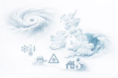
Britain is bracing for the first named storm of 2026 as Storm Goretti pushes north from northern France towards the United Kingdom, on course to collide with an entrenched Arctic air mass that has already produced the coldest temperatures of the winter, record snowfall and widespread disruption to transport, schools and health services. The WP Times reports, citing official warnings from the UK Met Office, Météo-France and the UK Health Security Agency, as forecasters warn that the combination of deep freeze, heavy snow and ice could create dangerous conditions across large parts of Britain in the days ahead.
What is Storm Goretti and why is it so dangerous for Britain
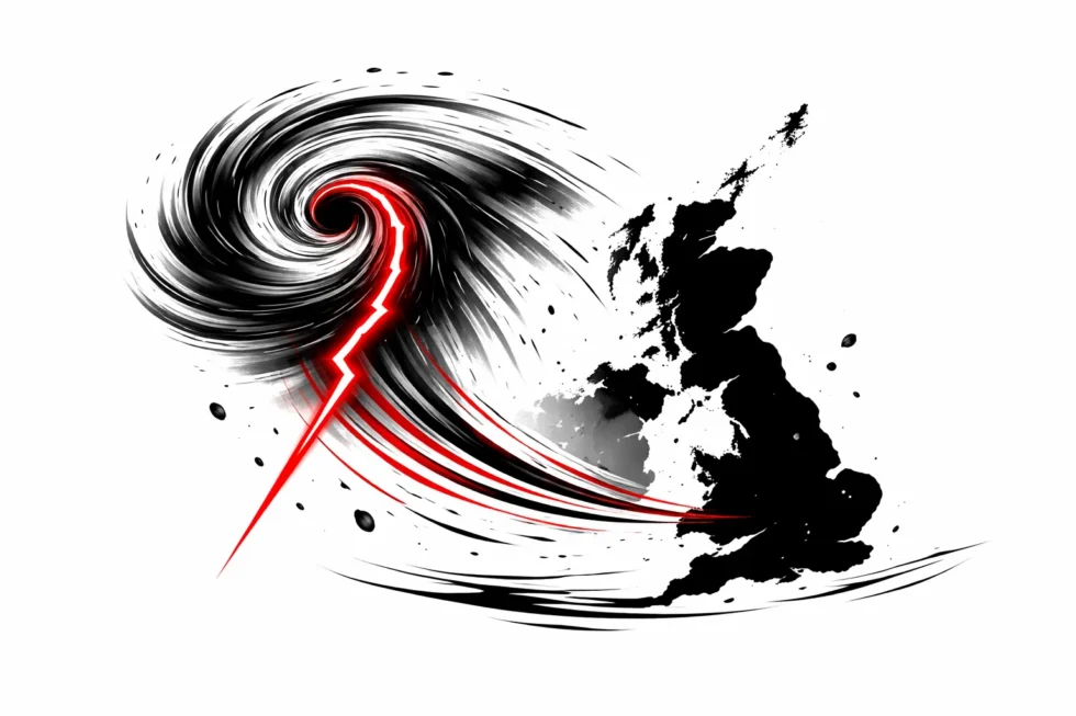
Storm Goretti was officially named by Météo-France, France’s national weather service, after a powerful Atlantic low-pressure system developed over western Europe and began tracking north-east toward the English Channel. While the storm’s core is expected to strike France, Britain lies directly in the zone where milder Atlantic air will collide with freezing Arctic air already in place over the UK, creating a highly unstable winter pattern.
This clash of air masses dramatically increases the risk of heavy snowfall, freezing rain and black ice, which can form within minutes as temperatures hover around zero. Meteorologists warn that this is one of the most dangerous winter scenarios for road safety, rail operations, electricity networks and emergency services, as conditions can deteriorate faster than standard weather models predict.
Where will Storm Goretti hit and which parts of the UK are at risk
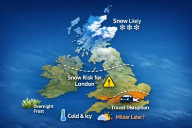
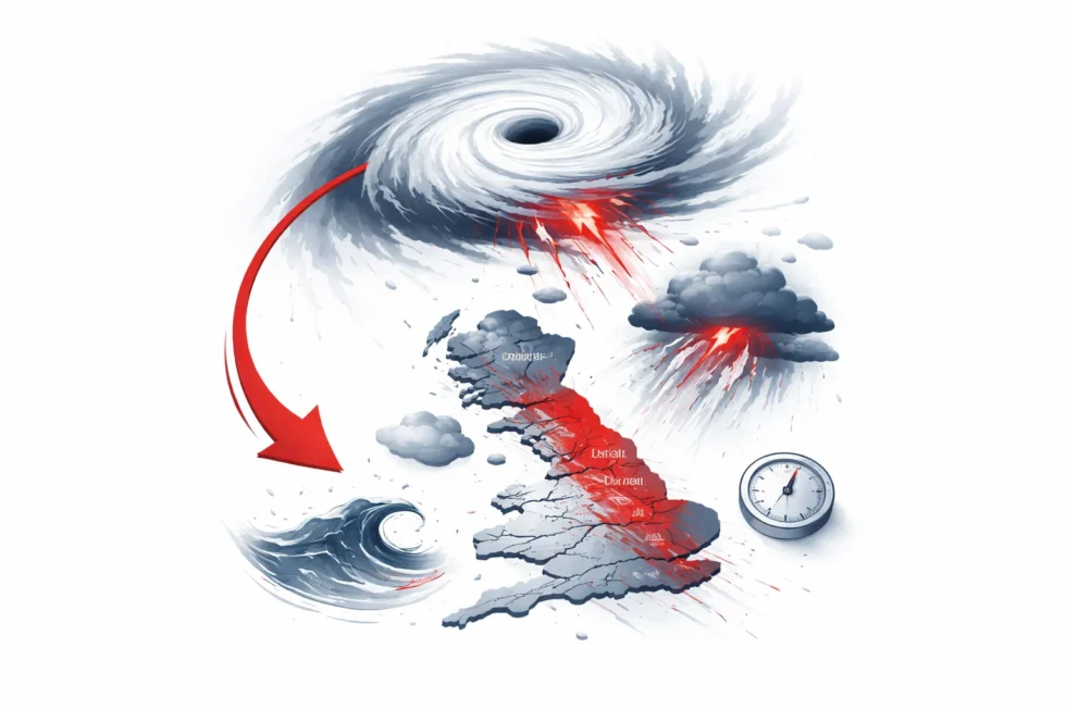
The Met Office has confirmed that Storm Goretti will primarily affect Wales, the Midlands, the South East and western England as it moves across the UK between Thursday evening and Friday afternoon. Northern England and parts of Scotland will remain exposed to additional snow showers and freezing conditions as the storm’s colder air wraps around its circulation.
Forecast models show that upland areas of south Wales, the Cotswolds, the Pennines and the Midlands face the greatest risk of disruptive snowfall, particularly where strong winds could create drifting snow and temporary road blockages.
What weather warnings are in force because of Storm Goretti
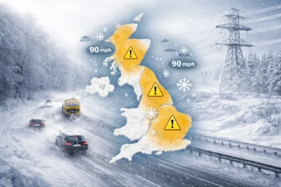
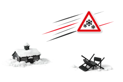
The Met Office formally activated Storm Goretti-related warnings on Tuesday 6 January as forecast confidence increased that the storm would push heavy snow into the UK later this week. A yellow snow warning is now in force from 6pm on Thursday 8 January until 12pm on Friday 9 January across much of Wales, the Midlands, south-east and western England.
Forecasters say this period marks the main impact window of Storm Goretti for Britain. During these 18 hours, 5 to 10 centimetres of snow is expected to settle widely, with up to 20 centimetres possible on hills and higher ground, particularly in south Wales, the Cotswolds and parts of the Midlands. Strong winds associated with the storm may cause drifting snow, increasing the risk of blocked roads and stranded vehicles.
Alongside the snow warning, yellow ice warnings remain in force across large areas of the UK, especially overnight and in the early morning. These are driven by a dangerous freeze–thaw cycle, where rain and melting snow refreeze into black ice on untreated roads, pavements and cycle paths.
The Met Office warns that the combination of snow, ice and gusty winds could result in major travel disruption, including rail and flight cancellations, power outages and a sharply increased risk of injuries from slips, falls and traffic accidents, as Storm Goretti moves through the country.
How cold has it already become across Britain
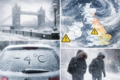
Storm Goretti is arriving on top of the coldest and most severe freeze of the winter so far, with temperatures across the UK dropping to levels that are rarely seen outside the deepest mid-winter spells. On Tuesday morning, the Met Officeconfirmed that parts of Britain had plunged well below –10°C, creating conditions more typical of northern Scandinavia than the British Isles.
The lowest recorded temperatures included:
- –11.2°C in Dalwhinnie, Highland Scotland
- –10.7°C in Tulloch Bridge, Inverness-shire
- –10°C in parts of Suffolk and North Yorkshire
- –9.6°C in Bala, Snowdonia, north Wales
In the Scottish Highlands, snow accumulation has already exceeded 30 centimetres in some areas, while freezing fog, drifting snow and black ice are now widespread. These conditions have made road and rail travel increasingly dangerous and have left some rural communities facing restricted access even before Storm Goretti’s main weather system reaches the UK.
How badly are schools and transport already affected
Winter conditions have already pushed parts of the UK into partial shutdown even before Storm Goretti arrives. On Tuesday, hundreds of schools across Scotland, Wales and Northern Ireland were forced to close because of snow, ice and unsafe travel conditions, with some rural and highland communities becoming temporarily isolated as roads were blocked by drifting snow.
The transport network is under extreme pressure. Dozens of flights have been cancelled at Aberdeen, Glasgow, Belfast and Liverpool John Lennon Airport, disrupting domestic and international travel. On the rail network, ScotRail and Network Rail Scotland have suspended or reduced services across northern and central Scotland, with snow and ice building up on tracks, points and overhead lines. In Glasgow, the entire subway system was shut down after ice on the third rail triggered a power failure, leaving commuters stranded across the city.
Road conditions are deteriorating rapidly. Motoring organisations including the AA and RAC report a surge in breakdowns, skidding incidents and stranded vehicles, as freezing fog, black ice and heavy snow make even short journeys hazardous. Emergency services warn that as temperatures remain below freezing, rescue and recovery times are lengthening, increasing the risk for anyone caught out on the roads.
Why has the UK issued an amber cold-health alert
The UK Health Security Agency (UKHSA) has placed all of England under an amber cold-weather health alert until 10am on Friday, signalling that the current freeze is not just uncomfortable but medically dangerous. An amber alert means cold weather is now expected to cause a measurable rise in illness, hospital admissions and deaths, especially among people aged 65 and over and those with heart, lung or long-term conditions.
In sustained sub-zero temperatures, the body works harder to stay warm. Blood vessels narrow, which raises blood pressure and increases the risk of heart attacks and strokes. At the same time, cold air irritates the airways, making chest infections, asthma and breathing problems more likely. When icy pavements and untreated roads are added to the mix, emergency services also see a surge in falls, fractures and head injuries, particularly among older people.
UKHSA warns that this type of cold spell can place severe pressure on the NHS, as ambulance call-outs, A&E attendances and hospital bed occupancy all rise at the same time. That is why the amber alert is not simply a weather notice, but a public-health warning urging households to keep homes warm, check on vulnerable neighbours, and avoid unnecessary exposure to freezing conditions while Storm Goretti approaches.
What should people do as Storm Goretti approaches
Emergency planners and the Met Office are urging the public to prepare now. People in affected areas should:
- Avoid non-essential travel during warning periods
- Check rail, road and flight updates before setting off
- Carry a winter kit in vehicles, including warm clothing, food, water, a blanket, a torch and a phone charger
- Keep mobile phones and power banks fully charged
- Check on elderly and vulnerable neighbours
- Ensure enough food and medication is available at home
Forecasters stress that weather warnings may change rapidly as Storm Goretti’s track becomes clearer, so residents should continue to monitor official updates.
Read about the life of Westminster and Pimlico district, London and the world. 24/7 news with fresh and useful updates on culture, business, technology and city life: Why Katie Miller, wife of Trump adviser Stephen Miller, posted Greenland in US colours — and why Denmark is furious