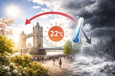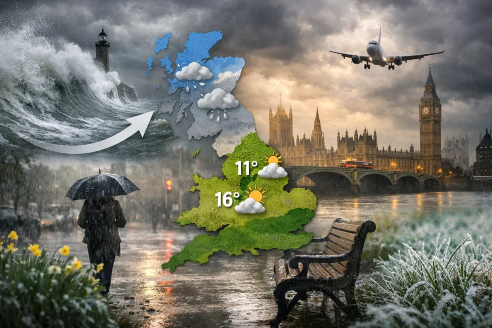
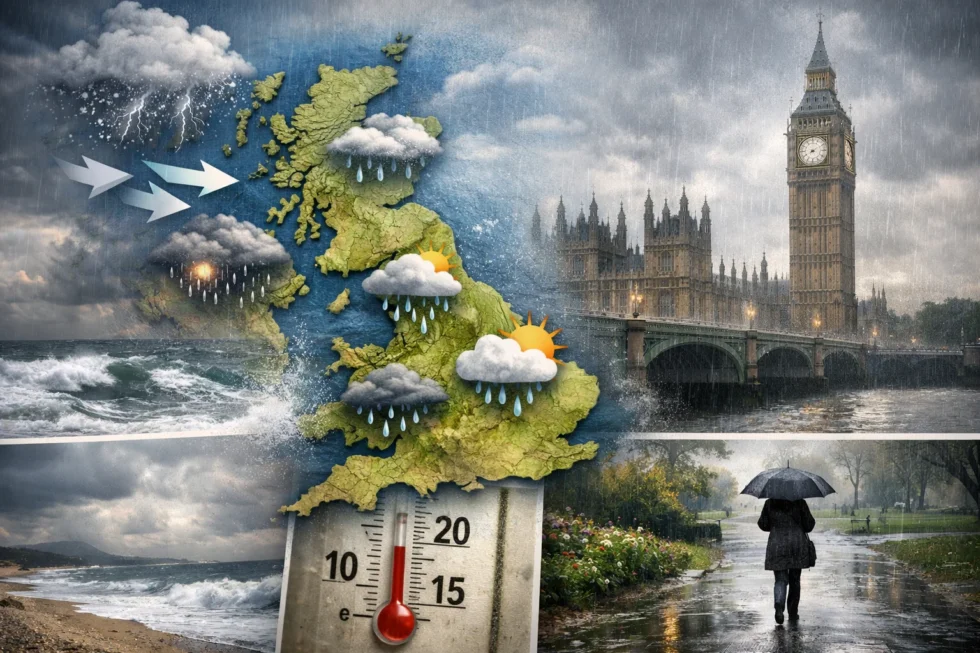
Weather tomorrow 14 April in London and the UK marks a decisive reversion to Atlantic-driven conditions, with temperatures stabilising at seasonal norms, widespread cloud cover and structured bands of rain moving west to east, as the Met Office confirms the collapse of the recent warm anomaly across Britain, The WP Times reports.The synoptic setup is now clearly defined by a low-pressure system anchored to the north-west of the British Isles, forcing a sustained westerly airflow that replaces the short-lived continental plume with cooler, moisture-laden maritime air. This shift not only reduces daytime temperature peaks to a controlled 11–16°C range but also introduces persistent atmospheric mixing, limiting solar gain and reinforcing cloud density across most regions.
The transition is structural rather than temporary, signalling a return to the UK’s dominant spring regime where Atlantic systems dictate short-term variability and restrict the formation of stable high-pressure blocks. According to the Met Office, this pattern is characterised by successive frontal systems, intermittent rainfall and moderate wind fields, with the strongest impact across western and northern areas exposed directly to incoming systems. In practical terms, this resets the UK weather baseline: instead of isolated warmth, conditions are now governed by controlled instability, where dry intervals are brief, temperatures remain capped, and daily forecasts depend on the precise timing of frontal passages rather than sustained sunshine.
Weather tomorrow 14 April in London and UK: Atlantic pattern defines conditions
In London, the day begins with overcast skies and patchy light rain, particularly during the morning commute. Conditions may briefly improve around midday with brighter intervals, but cloud dominance persists. Winds remain moderate from the west, preventing any significant temperature build-up.
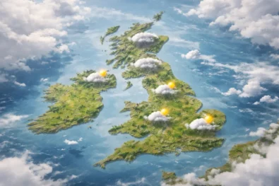
Across the UK, the weather structure follows a classic Atlantic distribution pattern:
| Region | Temperature | Conditions |
|---|---|---|
| London & South East | 14–16°C | Cloudy, light rain early |
| South West | 13–15°C | Showers, breezy |
| Midlands | 12–15°C | Cloud, occasional rain |
| North England | 11–14°C | Showers, wind |
| Wales | 12–15°C | Frequent showers |
| Scotland | 9–13°C | Cooler, rain bands |
| Northern Ireland | 11–14°C | Mixed, unsettled |
The north–south divide weakens, with all regions now aligned closer to seasonal averages. Scotland remains the coolest, influenced directly by incoming Atlantic fronts, while southern England retains slightly higher values due to residual ground warmth.
Why the warm spell ended: structural shift back to Atlantic flow
The breakdown of the previous warm conditions was both rapid and expected, driven by a shift in upper-level pressure systems. The earlier high-pressure ridge that enabled warm, stable air has now moved eastward into Europe, allowing Atlantic systems to reassert control over the UK’s weather. Key drivers behind the change:
- Westerly jet stream realignment over the UK
- Low-pressure systems tracking across the North Atlantic
- Increased cloud density limiting solar heating
- Maritime air replacing dry continental flow
This pattern reduces temperature extremes and increases day-to-day variability, which is typical for April in Britain.
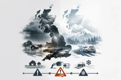
Weather tomorrow UK: rainfall, wind, geomagnetic activity and practical outlook
Rainfall on 14 April across the UK will follow a structured Atlantic pattern, arriving in clearly defined frontal bandsthat move from west to east and are followed by short-lived dry intervals. This means precipitation is not persistent but cyclical, with the highest frequency of showers concentrated in western regions — particularly Wales, western Scotland and parts of the South West. In contrast, eastern areas, including London, will experience more fragmented rainfall, with longer dry windows but continued cloud dominance.
Wind conditions remain an important operational factor. A moderate westerly flow dominates, with sustained speeds of 20–30 km/h and stronger coastal gusts reaching 40–55 km/h, especially along exposed Atlantic-facing coastlines. While no severe warnings have been issued by the Met Office, the overall system is noticeably more unsettled and dynamiccompared to the previous stable high-pressure phase.
Geomagnetic conditions and magnetic storms
On 14 April, geomagnetic activity is expected at G1 (minor storm) to G2 (moderate disturbance) levels, according to space weather monitoring aligned with agencies such as NOAA. This introduces an additional layer of environmental variability. Operational implications of geomagnetic activity:
- Increased physiological sensitivity (fatigue, headaches, reduced concentration) in susceptible individuals
- Slight disruptions in navigation systems and radio signals, though minimal at G1–G2 levels
- Potential amplification of weather perception, where wind and pressure changes feel more intense
While these effects do not directly alter meteorological conditions, they can influence human response to weather, particularly during periods of low pressure and increased cloud cover.
Practical impact across the UK
- Morning travel disruptions likely due to intermittent rain and wet road surfaces
- Reduced visibility during peak cloud density and passing fronts
- Wind exposure in coastal and elevated areas may affect transport stability
- Outdoor planning requires flexible timing windows between rain bands
- Evening temperatures drop to 7–9°C, reinforcing a cooler feel
Pollen levels and air quality on 14 April
The shift to a more humid and mobile air mass leads to a temporary suppression of pollen levels, particularly compared to the elevated concentrations recorded during the previous warm spell. However, tree pollen (birch and alder) remains present at moderate levels, especially across southern and central England.
Air quality shows measurable improvement, driven by stronger atmospheric mixing. The westerly airflow effectively disperses accumulated pollutants, reducing stagnation that had built under earlier high-pressure conditions. This results in cleaner but more humid air, with lower particulate concentration but increased moisture content.
Outlook beyond 14 April: controlled instability and temperature fluctuation
The UK remains locked in a transitional spring regime, where no dominant high-pressure system establishes long-term stability. Instead, the pattern is defined by alternating Atlantic fronts and brief ridging phases, producing a sequence of mixed conditions.
| Date | Temperature | Conditions |
|---|---|---|
| Tue 14 Apr | 11–16°C | Cloud, showers |
| Wed 15 Apr | 12–17°C | Brighter intervals, partial clearing |
| Thu 16 Apr | 10–14°C | Renewed rain bands, thicker cloud |
| Fri 17 Apr | 11–15°C | Mixed conditions, unstable |
The key structural takeaway is that temperature variability remains limited but persistent, with no immediate return to sustained warmth. Instead, Britain continues to operate within a controlled but unsettled atmospheric cycle, typical of mid-April conditions.
Sunrise and sunset times on 14 April in London and UK
On 14 April, daylight duration across the UK continues to expand rapidly as spring progresses, directly influencing temperature recovery during short brighter intervals between cloud bands. In London, sunrise is at approximately 06:07 and sunset at 19:55, providing nearly 14 hours of daylight; however, under the Atlantic-driven pattern confirmed by the Met Office, much of this solar window is filtered by dense cloud and passing rain fronts. This means that despite longer days, effective surface warming remains limited and uneven across regions.
Across Britain, sunrise and sunset times vary by latitude, with northern regions experiencing earlier sunrise and later sunset. The differences are operationally relevant for temperature distribution and evening cooling rates:
| Region | Sunrise | Sunset | Daylight |
|---|---|---|---|
| London & South East | 06:07 | 19:55 | ~13h 48m |
| South West (Bristol) | 06:15 | 19:58 | ~13h 43m |
| Midlands (Birmingham) | 06:10 | 19:57 | ~13h 47m |
| North England (Manchester) | 06:08 | 20:02 | ~13h 54m |
| Wales (Cardiff) | 06:14 | 20:00 | ~13h 46m |
| Scotland (Edinburgh) | 06:05 | 20:10 | ~14h 05m |
| Northern Ireland (Belfast) | 06:12 | 20:06 | ~13h 54m |
The key takeaway is that longer daylight does not currently translate into stronger warming, as cloud density and Atlantic airflow continue to dominate the UK’s weather structure on 14 April.
Read about the life of Westminster and Pimlico district, London and the world. 24/7 news with fresh and useful updates on culture, business, technology and city life: Fuel prices surge: what is the jet fuel price impact airlines and what happens next for travellers