Met weather and BBC weather forecasts for Tuesday 28 April and Wednesday 29 April 2026, based on guidance from the Met Office, indicate a clearly defined short-term shift across the UK, with a brief phase of warmer, brighter conditions before a transition to more unsettled weather ahead of the Bank Holiday weekend. Weather today London follows this national pattern in sequence, with early cloud and patchy drizzle giving way to brighter spells, followed by a steady rise in temperature into the latter part of the week, The WP Times reports.
The Met Office said temperatures would move above the late-April average across much of England, supported by midweek high pressure, before Atlantic systems bring increasing cloud, rain and a risk of heavy, possibly thundery showers from Friday. BBC Weather forecasts align with this outlook, pointing to sunshine through midweek followed by a more changeable pattern extending across England, Wales, Scotland and Northern Ireland as the weekend approaches.
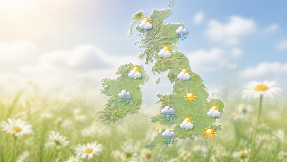
Weather today London: what changes on 28 and 29 April
Weather today London on Tuesday 28 April starts with more cloud than sunshine, and some patchy drizzle is possible during the earlier part of the day. Conditions are expected to improve later, with brighter intervals developing across London and the South East.
Wednesday 29 April brings the more settled part of the week. The BBC weather and Met weather outlook both point to largely dry conditions, sunny spells and a gradual rise in temperature across southern England.

This is the short window of useful spring weather before the late-week change. For London, the best conditions are expected from Wednesday into Thursday, before showers become more likely from Friday.
UK forecast: temperature and weekend outlook
| UK area | 28–29 April outlook | Temperature trend | Bank Holiday weekend risk |
|---|---|---|---|
| London and South East | Cloud clearing, sunny spells | Up to 20–24°C later in week | Showers possible, still mild |
| South West England | Sunny spells, breezy, coastal wind | Around 18–20°C | Showers spreading first |
| Midlands | Dry spells, brighter by Wednesday | Around 18–23°C | Mixed, showers likely |
| North England | Variable cloud, some sun | Around 16–21°C | Cooler, showers at times |
| Scotland | Mixed, some showers | Around 14–19°C | Changeable, wetter in places |
| Wales | Dry spells midweek | Around 17–21°C | Showers increasing |
| Northern Ireland | Bright intervals, variable cloud | Around 16–20°C | Rain or showers from west |
The key temperature point is Friday. The Met Office said parts of central and southern England could reach 24°C before the breakdown arrives. That means the warmest conditions may come just before the weather becomes more unstable.
Why the weather changes before the Bank Holiday weekend
The midweek warmth is driven by high pressure, which maintains dry conditions and supports rising temperatures across much of the UK. This system weakens from late Thursday, allowing Atlantic fronts to move in from the southwest. Rain bands and showers spread across the country from Friday, with a risk of locally heavy and thundery bursts where warm and humid air remains in place ahead of the фронта. The Bank Holiday weekend is therefore expected to shift into a changeable pattern, with alternating sunshine and showers rather than prolonged rainfall, and clear regional differences between drier southern areas and wetter northern and western regions.
What it means for food, travel and outdoor plans
The practical impact is defined by timing. Wednesday and Thursday offer the most reliable window for outdoor activity across much of the UK, particularly in London, the South East and central England, where dry conditions and higher temperatures are expected.
During this period, the weather supports lighter food choices and outdoor routines, including simple meals, fresh produce and open-air dining. By Friday, as humidity increases ahead of incoming showers, conditions become less stable, requiring more flexible planning.
Over the Bank Holiday weekend, the shift to a changeable pattern means outdoor plans carry higher risk. Showers are likely to be intermittent rather than continuous, but timing will vary by region, with the north and west seeing more persistent rain than the south and east.
“By Friday, conditions are expected to become more unsettled, with rain and showers spreading in from the southwest, some of which could be heavy and possibly thundery,” said Tom Crabtree, Deputy Chief Forecaster at the Met Office.
“Ahead of this, it will feel warm and humid in parts of England on Friday, with temperatures potentially reaching 24°C in central and southern areas,” he added.
The current met weather and BBC weather outlook does not indicate a sustained heatwave. It reflects a short-lived warm phase followed by a return to typical spring variability. For weather today London, the sequence remains consistent: improving conditions from Tuesday afternoon, the most stable weather midweek, peak warmth towards Friday, and an increasing likelihood of showers into the weekend.
UK weather outlook: 28 April – 5 May 2026
| Date | Day | UK outlook | Temperature trend | Planning advice |
|---|---|---|---|---|
| 28 Apr | Tuesday | Cloud early, patchy drizzle, brighter later | 15–20°C | Afternoon better for outdoor plans |
| 29 Apr | Wednesday | Mostly dry, sunny spells | 17–22°C | Best stable day midweek |
| 30 Apr | Thursday | Warm, sunny, breezy in south | 20–23°C | Ideal for outdoor activities |
| 1 May | Friday | Warm, humid, showers developing | 22–24°C | Last warm day before change |
| 2 May | Saturday | Sunshine and scattered showers | 16–21°C | Flexible plans needed |
| 3 May | Sunday | Changeable, showers frequent north/west | 15–20°C | Indoor backup recommended |
| 4 May | Monday | Mixed, sunny intervals and showers | 15–20°C | Check local forecast |
| 5 May | Tuesday | Gradually stabilising, fewer showers | 16–21°C | Conditions improving |
UK forecast: clear transition from warm to unsettled
The period from 28 April to 5 May shows a structured shift in UK weather. Early and midweek conditions remain relatively stable, with increasing sunshine and temperatures rising above the seasonal average. The peak arrives on Thursday 30 April and Friday 1 May, when parts of southern England, including London, may reach up to 24°C under warm and humid conditions.
From late Friday, the pattern breaks down. Atlantic systems move in from the southwest, bringing rain bands, showers and a risk of isolated thunderstorms. This shift defines the Bank Holiday weekend, which becomes mixed rather than persistently wet. Northern and western areas face the highest rainfall frequency, while southern and eastern regions retain brighter intervals between showers.
Read about the life of Westminster and Pimlico district, London and the world. 24/7 news with fresh and useful updates on culture, business, technology and city life: Tesco QR Codes Transform UK Supermarket Barcodes in Sausage Range First Rollout