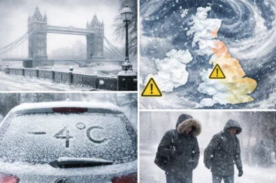
The United Kingdom is bracing for a period of severe meteorological instability as the Met Office has issued a series of Yellow Weather Warnings for the upcoming Easter bank holiday weekend. A powerful Atlantic low-pressure system is set to collide with a "significant cold plunge" from the north, generating fierce gusts of up to 90mph in exposed regions and widespread travel chaos across Scotland, Northern Ireland, and northern England. For millions of Britons planning Easter getaways, the intersection of peak holiday transit and extreme weather creates a high-risk scenario for infrastructure damage, power outages, and maritime hazards. This is reported by The WP Times, citing TheSUN.
Meteorological Breakdown: The 90mph "Easter Blast"
The weather warning, which comes into force at 6:00 pm on Saturday, April 4, 2026, and remains active until 12:00 pm on Easter Sunday, highlights a localized but extreme threat. While much of the UK will experience "blustery" conditions with gusts between 50 and 60 mph, the Met Office has identified specific high-risk zones where the topography and pressure gradients will amplify wind speeds to dangerous levels. In western Scotland and the Highlands, forecasters warn that gusts could reach a staggering 90 mph, a velocity capable of causing structural damage to buildings and uprooting trees.
- Peak Warning Period: Saturday, April 4 (18:00) to Sunday, April 5 (12:00).
- Maximum Gusts: 80–90 mph in Western Scotland; 60–70 mph in exposed coastal areas of Wales and North West England.
- Cold Front Impact: Temperatures are expected to plummet as a cold front moves south, bringing rural frosts as low as -5 °C before the wind picks up.
- Precipitation: Heavy rain and showery outbreaks are forecast to accompany the wind, particularly across the Pennines and northern coastal belts.
Extensive Travel Disruption and Infrastructure Risks
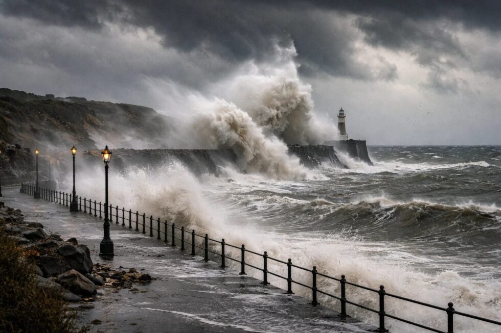
The timing of this storm is particularly problematic as it coincides with one of the busiest travel weekends of the year. Transport authorities have warned that major bridges, including those in North Wales and across the Scottish Firths, may be subject to closures or restrictions for high-sided vehicles. Rail services are also at risk due to potential debris on tracks and overhead line damage. Furthermore, the Met Office has raised concerns regarding "large waves and beach material" being thrown onto coastal roads, posing a direct threat to life and property in seafront locations.
"We have issued yellow warnings for wind for Scotland, Northern Ireland, and northern parts of both England and Wales for Saturday night and into Sunday, when a spell of very strong winds could cause disruption. Winds should gradually ease through Easter Sunday as the area of low pressure clears to the North Sea." – Official Met Office Spokesperson Statement.
- Road Closures: Likely for exposed routes and major bridges (e.g., Menai Bridge, Skye Bridge).
- Power Supply: Potential for localized power cuts, impacting mobile network coverage and domestic heating.
- Maritime Safety: Significant risk to small craft; coastal injuries possible due to "shingle and debris" projectiles from high waves.
- Structural Damage: Risk of tiles being blown from roofs and damage to garden structures like sheds and fences.
Geographical Impact Zones for 2026 Easter Weekend
The current Met Office alerts cover a vast swathe of the British Isles, with the intensity varying by region. Northern Ireland and Scotland are expected to bear the brunt of the Atlantic system, while northern English counties will face a combination of high winds and plummeting temperatures. The transition from a "mild midweek" (where temperatures reached 16 °C) to this wintry, stormy weekend represents a 20 °C swing in "felt" temperature for many regions.
| Region | Primary Warning | Key Areas Affected |
| Scotland | Yellow (Wind) | Highlands, Western Isles, Strathclyde, Grampian |
| Northern Ireland | Yellow (Wind) | All counties (Belfast, Derry, Antrim) |
| North West England | Yellow (Wind) | Merseyside (Liverpool), Blackpool, Cumbria, Lancashire |
| North East England | Yellow (Wind) | Newcastle upon Tyne, Sunderland, Durham |
| North Wales | Yellow (Wind) | Gwynedd, Isle of Anglesey, Conwy, Flintshire |
Practical Recommendations for Holiday Travel
Given the severity of the forecast for the Easter weekend, experts recommend a "prepare and monitor" strategy for all residents in the yellow warning zones. The Met Office advises securing loose garden items such as trampolines, which can become dangerous projectiles in 70+ mph winds. Travelers are urged to complete long-distance journeys before 6:00 pm on Saturday or delay departure until Sunday afternoon when the system is expected to move into the North Sea.
- Property Safety: Check and secure bins, garden furniture, and trampolines.
- Travel Planning: Verify rail and ferry timetables 24 hours in advance; check road conditions via National Highways or Traffic Scotland.
- Emergency Kit: Ensure mobile phones are charged and have a torch/batteries ready in case of power outages.
- Coastal Caution: Avoid seafronts and piers during high tide on Saturday night and Sunday morning.
Frequently Asked Questions
Which parts of the UK will see 90mph winds?
The strongest gusts of 80–90 mph are primarily forecast for Western Scotland and highly exposed coastal headlands.
When exactly does the weather warning start?
The Yellow Warning for wind begins at 6:00 pm (18:00) on Saturday, April 4, 2026.
Will the weather improve for Easter Monday?
Current forecasts suggest the low-pressure system will clear into the North Sea by Sunday afternoon, leading to more settled (though potentially chilly) conditions by Monday.
Are trains running during the warning?
Disruption is likely. Passengers should check with Northern, ScotRail, or TransPennine Express for specific service cancellations.
Will the ferries be cancelled?
Ferries in the Irish Sea and to the Scottish Isles are at high risk of cancellation or severe delay due to sea states and high winds.
How cold will it get?
A cold front ahead of the storm will bring temperatures down to -5 °C in rural northern areas on Wednesday/Thursday night, staying chilly throughout the weekend.
Read about the life of Westminster and Pimlico district, London and the world. 24/7 news with fresh and useful updates on culture, business, technology and city life: Diplomatic Crisis Escalates: Russia Expels British Diplomat Amid Allegations of Economic Espionage