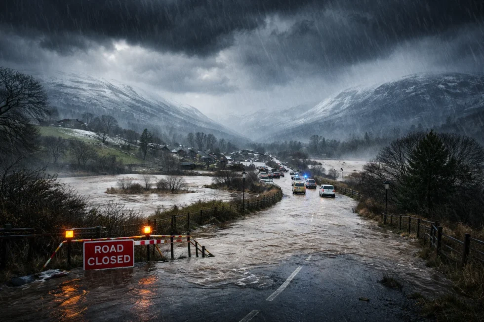
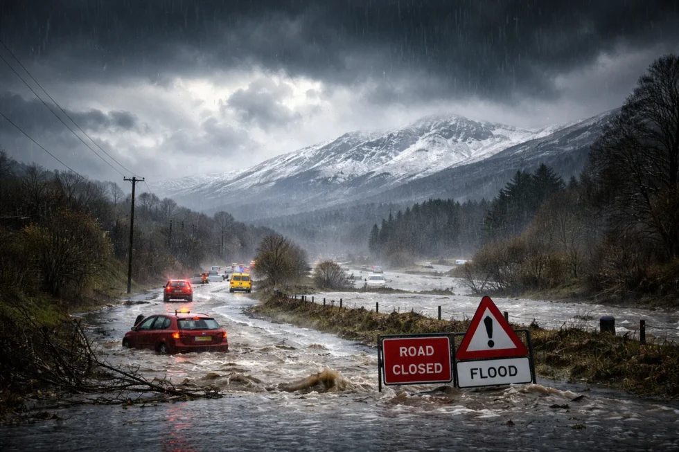
The UK enters the new week under continued unsettled weather conditions, with persistent rain, elevated flood risk and hill snow affecting large parts of the country on Monday, 2 February 2026, according to the Met Office.Although no named storm is currently active, several days of heavy rainfall have left soils fully saturated and rivers running high, significantly increasing the likelihood of flooding even from modest additional rain. At the same time, colder air pushing south across northern Britain is creating wintry hazards over higher ground, particularly in Scotland and northern England.
As a result, weather-related disruption remains a real concern for households, commuters and travellers, including slower journeys, local road flooding, rail delays and icy conditions on exposed routes, reports The WP Times editorial team. This guide explains what is driving the current weather pattern, why impacts may persist even as winds ease, which regions are most exposed, and what practical steps people should take to stay safe and minimise disruption.
Weather remains unsettled: what is driving disruption across the UK
Unsettled weather continues across the UK at the start of the week, with forecasters warning that conditions are unlikely to improve quickly. The Met Office says a slow-moving Atlantic system is responsible, feeding moist air across the country while progressing only gradually. As a result, bands of rain are lingering over the same areas for hours rather than passing through quickly.
Unlike fast-moving storms that bring short bursts of heavy rain, this pattern is producing steady, cumulative rainfall. The main impacts are being driven not by intensity, but by duration. After several wet days, soils in many parts of the UK are already saturated, meaning fresh rain now runs straight into rivers and drains instead of soaking into the ground.
Why flood risk is elevated
With the ground fully waterlogged, rivers and drainage systems are close to capacity. Even modest rainfall can now trigger surface water flooding and rapid rises in river levels. In northern Britain, colder air moving south is adding further complications, introducing snow and ice risks on higher ground and increasing the likelihood of hazardous travel.
The Environment Agency says Monday’s flood risk is linked mainly to what has already fallen, not just what is forecast.
Put simply:
- soil can no longer absorb extra water
- rivers respond more quickly to rainfall
- drains are easily overwhelmed
- floodwater drains away over days, not hours
This means even brief showers may cause flooding in vulnerable locations.
Rain forecast by region

Southern and western England and Wales
Areas including Bristol, Cardiff, Plymouth and Exeter are expected to see rain for much of Monday. Rain bands will move slowly, prolonging wet conditions, with totals of around 5–15 mm and locally higher amounts. The main concern is surface water and river flooding rather than extreme downpours.
The Midlands
Cities such as Birmingham, Coventry, Leicester and Nottingham will experience spells of rain and drizzle throughout the day. Flood risk is higher in low-lying neighbourhoods, rural roads and communities close to rivers, where drainage is already under strain.
Northern England
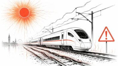
Manchester, Leeds, Sheffield and Newcastle will see rain at lower levels, with sleet or snow possible on hills, especially overnight. Falling temperatures increase the risk of ice on untreated routes, particularly in upland areas.
Areas most at risk of flooding
- South West England, especially the Somerset Levels
- Southern and central England river catchments
- Low-lying towns, flood plains and rural villages
- Roads running alongside streams and drainage ditches
In parts of Somerset, flood management operations remain active as water drains slowly from farmland and residential areas. Some roads may remain closed into the week.
Will it snow
Snow will not be widespread but remains a significant risk in specific regions:
- Scottish Highlands: Snow above 300 metres, with 5–10 cm possible on exposed routes. High risk of icy roads and poor visibility.
- The Pennines: Rain turning to snow on higher ground, most likely early in the day and overnight.
- Northern hills: Mainly rain at lower levels, with sleet or snow at elevation.
- Southern England and London: No snow expected, with temperatures staying above freezing.
UK weather overview: Monday
| Region | Conditions | Temperatures | Main risks |
|---|---|---|---|
| Southern England | Persistent rain, breezy | 5–8°C | Surface water flooding, slow travel |
| Midlands | Cloudy, rain and drizzle | 3–6°C | Local flooding, poor drainage |
| Northern England | Rain, snow on hills | 2–5°C | Ice on upland routes |
| Scotland | Wintry on high ground | –1°C to 3°C | Snow, icy roads, poor visibility |
| Wales | Prolonged rain | 4–7°C | River and surface flooding |
London and the South East
London and the surrounding region will see a wet but relatively mild day:
- Temperatures: 5–7°C
- Wind: South-easterly, 15–25 mph
- Rain: Light to moderate but persistent
The main risks for commuters are surface water on roads, slower traffic during rush hours and possible rail delays where tracks remain waterlogged.
Travel disruption: what to expect
Roads
- Standing water on rural and suburban routes
- Risk of vehicles stalling in floodwater
- Night-time ice possible in northern regions
Rail
- Delays on waterlogged lines
- Speed restrictions in affected areas
Air and ferries
- Fewer wind-related cancellations than last week
- Some knock-on delays still possible
Drivers are strongly advised not to attempt to drive through floodwater, even when it appears shallow.
Forecasters expect gradual improvement from Tuesday, with rain becoming more scattered and brighter spells developing, especially in the south. However, river levels are likely to remain high, meaning flood impacts may continue even after rainfall eases. For households and commuters, the message remains one of caution. Flood effects may linger for several days, travel reliability will vary by region, and snow or ice could still affect northern routes. Short dry spells do not mean an immediate return to normal conditions.
Read about the life of Westminster and Pimlico district, London and the world. 24/7 news with fresh and useful updates on culture, business, technology and city life: When is the Snow Moon tonight in the UK and how visible will the full moon be on 1 February