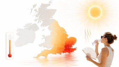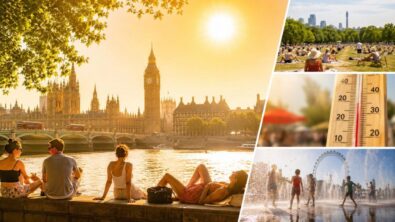
Heatwave conditions have officially been reached across eight parts of England after temperatures climbed above 32C at Heathrow during the third consecutive day of extreme May heat. Santon Downham in Suffolk became the first location to meet the official Met Office threshold at around 11:30 BST on Sunday before several sites across London, Essex and Oxfordshire followed, as Britain experienced what forecasters described as one of the hottest May periods in nearly 80 years, The WP Times reports amid escalating weather warnings across England.
The Met Office confirmed Heathrow reached 32.1C on Sunday afternoon, while forecasts suggest temperatures could rise further to 33C or even 34C on Bank Holiday Monday in parts of southern England and the Midlands. Amber heat health alerts issued by the UK Health Security Agency remain active until Wednesday for London, the East Midlands, West Midlands, South East and East of England, with officials warning of increased pressure on healthcare systems and elevated health risks for vulnerable residents.
Which areas officially reached heatwave conditions in England
The Met Office confirmed that eight locations met the official heatwave definition after recording temperatures above regional thresholds for three consecutive days. In the UK, heatwave criteria vary by area depending on historical climate averages. London and surrounding regions typically require temperatures of at least 28C across three days, while cooler regions operate with lower thresholds around 25C to 27C.
Santon Downham in Suffolk was the first site to officially qualify shortly before midday on Sunday. Heathrow followed minutes later, before additional monitoring stations in Essex, Oxfordshire and Greater London crossed the threshold. According to the Met Office, the event expanded rapidly during the afternoon as temperatures continued climbing across southern and eastern England. The current heatwave is unusual not only because of the temperature itself, but because of its timing in late May rather than mid-summer.
Forecasters also stressed that Scotland has not officially entered heatwave territory despite experiencing its warmest conditions of the year so far. Northern and western Scotland remained cooler because of Atlantic airflow and cloud cover.
Locations confirmed under heatwave criteria
| Location | Region | Heatwave threshold | Status |
|---|---|---|---|
| Santon Downham | Suffolk | 27C | Confirmed |
| Heathrow | Greater London | 28C | Confirmed |
| Kew Gardens | London | 28C | Confirmed |
| Northolt | London | 28C | Confirmed |
| Benson | Oxfordshire | 27C | Confirmed |
| Writtle | Essex | 27C | Confirmed |
| High Beech | Essex | 27C | Confirmed |
| Brooms Barn | Suffolk | 27C | Confirmed |
Heathrow reaches 32.1C as temperatures approach May records
Sunday became the hottest day of 2026 so far after Heathrow officially recorded 32.1C during the afternoon. The figure places the current weather event among the most intense May heat episodes recorded in modern British meteorological history. The standing UK May temperature record remains 32.8C, originally set in Camden Square in London in 1922 and matched in several southern English locations in 1944.
Meteorologists believe that record could now be broken within hours if temperatures rise as forecast on Monday. The Met Office stated that parts of Greater London and south-east England may reach 34C under prolonged sunshine and stable high-pressure conditions moving north from continental Europe. Such temperatures are rare even during peak summer in Britain, making the late-May timing particularly significant.
The broader pattern has also pushed temperatures in England above levels seen simultaneously in parts of southern Europe. Some forecasters noted that London temperatures on Sunday exceeded readings in Ibiza, Los Angeles and Casablanca.
Highest recorded temperatures during the heatwave
| Area | Temperature |
|---|---|
| Heathrow | 32.1C |
| South-East England forecast Monday | Up to 34C |
| Frittenden, Kent (Saturday) | 30.5C |
| Cardiff | 27.4C |
| Edinburgh | 23.5C |
Amber heat alerts remain active across England
The UK Health Security Agency maintained amber heat health alerts through Wednesday across large parts of England due to concerns over mortality risk, pressure on hospitals and overheating in buildings. The alerts cover London, the South East, the East of England and the Midlands. Yellow alerts remain in force for several northern and western regions.
Authorities warned that older people, infants and individuals with respiratory or cardiovascular conditions face the highest risk during prolonged heat exposure. Hospitals and care facilities have been advised to monitor hydration levels and indoor temperatures closely. The warning system is designed not simply around outdoor heat, but around cumulative health impact across several days and nights.
Transport agencies are also monitoring the situation closely. Transport for London advised passengers to carry water and prepare for extremely warm conditions on Underground and rail services. Some infrastructure operators remain alert for possible rail expansion issues and network delays if temperatures continue climbing.
Why the current UK heatwave is considered historically unusual
Meteorologists repeatedly described the current weather pattern as highly unusual for May because of the persistence and scale of the heat. The Met Office explained that a large high-pressure system over Europe is drawing exceptionally warm air northward into Britain while maintaining dry and sunny conditions.
Steve Kocher, Deputy Chief Forecaster at the Met Office, said forecast temperatures could surpass both the May and spring seasonal records. According to official forecasts, the event may become one of the warmest spring heat episodes recorded in the UK.
“It is likely that the May and Spring UK temperature records will be broken,” (Steve Kocher, Met Office, 21 May 2026)
Climate scientists have increasingly linked earlier and more intense spring heat events to long-term warming trends affecting Europe. However, the Met Office continues to describe the current situation primarily as a result of persistent high pressure and continental airflow patterns rather than a single isolated phenomenon.
Why this heatwave stands out
- Temperatures exceeded 32C in May
- Heatwave conditions spread across eight English regions
- Forecasts suggest up to 34C possible
- Amber heat health alerts remain active until Wednesday
- The event arrived unusually early in the season
- Overnight “tropical night” conditions are possible in London
What forecasters expect over the next 72 hours
Weather models suggest Monday could become the peak of the current heatwave, particularly across London, Essex, Kent and the Midlands. Temperatures are expected to remain above average into Tuesday before slowly easing later in the week. Despite a gradual decline, many areas are still expected to stay significantly warmer than seasonal norms.
Forecasters are also monitoring the possibility of “tropical nights” in London, meaning overnight temperatures may remain above 20C. These conditions are uncommon in Britain and increase heat stress because buildings and bodies are unable to cool effectively overnight.
Western Scotland and Northern Ireland are expected to remain cooler because of cloud cover and Atlantic systems approaching from the west. However, most of England and Wales are forecast to continue experiencing strong sunshine, elevated UV levels and limited rainfall through the Bank Holiday period.
Forecast outlook
| Day | Main areas affected | Forecast maximum |
|---|---|---|
| Sunday | London and South East | 32C |
| Monday | South East and Midlands | 33–34C |
| Tuesday | Southern England | 29–31C |
| Wednesday | Central and Eastern England | 26–29C |
Read about the life of Westminster and Pimlico district, London and the world. 24/7 news with fresh and useful updates on culture, business, technology and city life: How Morrisons became first UK supermarket to add male sanitary bins in all 500 stores