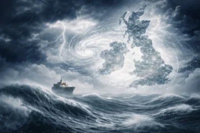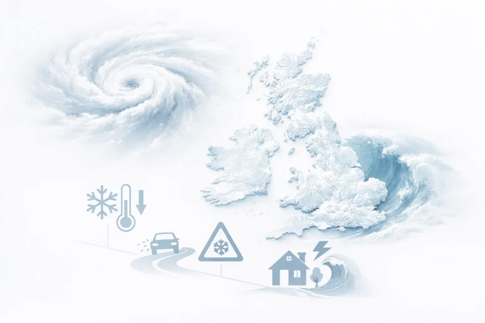
LONDON, Wednesday 7 January 2026 — The United Kingdom is bracing for one of the most complex and potentially disruptive winter weather events in years as Storm Goretti, the first named Atlantic storm of 2026, collides with entrenched Arctic air over the country. Forecasters warn that the result will be a rare “multi-hazard” system combining heavy snow, freezing rain, gale-force winds and widespread ice, threatening transport networks, power supplies and public safety across large parts of Britain. The WP Times reports, citing the UK Met Office, Aberdeenshire Council, National Rail and Eurostar.
The Met Office has placed almost the entire country under weather warnings, with ice alerts stretching across England and Northern Ireland and snow and ice warnings in force across northern Scotland, where conditions are already approaching crisis levels after two days of severe snowfall.
Scotland already in emergency conditions
On Tuesday, Aberdeenshire Council declared a major incident as blizzards and drifting snow cut off villages, blocked key roads and raised the risk of widespread power failures. Officials warned there was a “good chance” that rural communities could become isolated for several days and that emergency services might struggle to reach vulnerable residents.
For a third consecutive day, hundreds of schools remain closed across Scotland. Nationwide on Tuesday, more than 300 schools were shut in Scotland, 300 in Wales, 200 in Northern Ireland and over 100 in England. Many of those closures remain in place on Wednesday as freezing conditions persist.
A storm built for disruption
Storm Goretti is being treated as a high-impact system because of the way it is interacting with the existing cold air mass over the UK. Chris Bulmer, Deputy Chief Forecaster at the Met Office, said the storm will “clash with very cold air already over the UK”, producing sharply divided weather zones that greatly increase the danger.
Northern parts of the storm will bring persistent snowfall, southern regions will see strong winds and driving rain, while central areas are expected to experience freezing rain, one of the most dangerous winter hazards because it coats roads, railways, trees and power lines in a layer of solid ice.
Forecasters say snow accumulations of 5–10cm are likely today in Aberdeenshire, the Highlands and the Northern Isles, with up to 20cm possible on higher ground across central Scotland and northern England by the end of the week.
Temperatures in rural Scotland are forecast to fall to –6°C overnight, ensuring that any moisture will refreeze rapidly and create extreme black-ice conditions.
Transport networks already buckling
The growing severity of the weather is already being felt on Britain’s transport systems. Eurostar has cancelled or delayed multiple services between London and Paris, Amsterdam and Rotterdam, citing adverse weather conditions affecting power and track systems.
National Rail has warned that snow and ice can:
- Block track points
- Damage overhead power lines
- Prevent trains without snowploughs from operating safely
Passengers have been urged to check live service updates before travelling, with further disruption expected through Thursday and Friday. Road authorities have also warned that untreated rural roads in Scotland, northern England, Wales and the Midlands will become increasingly dangerous as temperatures drop again overnight.
How cold will it be today
Despite slightly milder air reaching the south of England, conditions remain hostile nationwide.
The Met Office forecasts daytime highs of 8°C in south-west England and 6°C in the south and east, but Scotland will remain close to freezing, with temperatures of 0–3°C and severe frost expected after dark. Central and northern England will fall back towards 2°C overnight, while south-east England is expected to reach around 4°C.
Storm Goretti is forecast to reach England and Wales on Thursday, spreading north into Scotland on Friday. Forecasters say the most dangerous window for heavy snow, gale-force winds, power cuts and transport shutdownswill be Thursday night into Friday morning.Emergency planners are preparing for multi-day disruption rather than a short-lived winter spell.
The combination of Atlantic storm energy colliding with entrenched Arctic air is the same setup that has driven Britain’s most severe winter emergencies in recent decades. With schools, railways and power networks already under pressure, Storm Goretti is on track to become the defining weather event of winter 2026.
Read about the life of Westminster and Pimlico district, London and the world. 24/7 news with fresh and useful updates on culture, business, technology and city life: Storm Goretti shuts 1,000+ UK schools — where closures are and what families should do