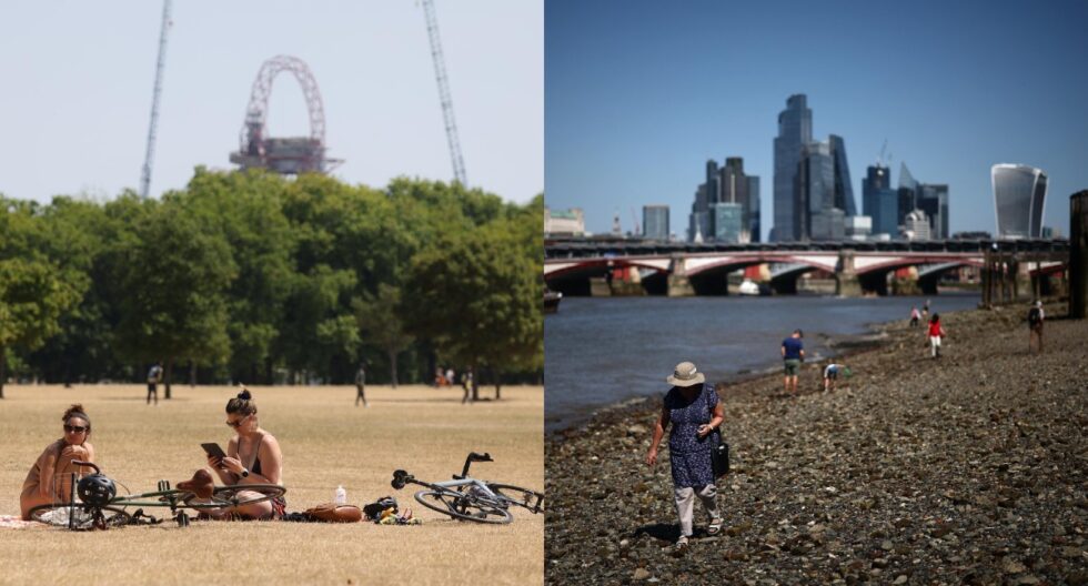
The United Kingdom is currently standing on the threshold of a dramatic meteorological shift that perfectly encapsulates the volatility of a British spring in 2026. This week, a powerful but brief surge of warm air is set to push temperatures to a peak of 24°C, providing a much-needed respite from recent winter-like conditions before a series of heavy downpours strikes the nation. For millions of residents across England, Wales, and Scotland, this rapid transition represents a classic weather paradox: a mid-week invitation to outdoor activities followed by a weekend that demands indoor refuge.
Understanding the timing of this thermal spike and the subsequent low-pressure system is essential for anyone planning travel, agricultural work, or social events over the coming days. As the warmth intensifies in the south, the contrast with the impending Atlantic fronts will mark one of the most significant weather shifts of the season so far, as reported by The WP Times via independent.
Regional Temperature Breakdown: Where the 24°C Peak Will Hit
The distribution of warmth across the UK this week is following a highly uneven pattern, with a stark "North-South divide" dictating the daily experience of residents. While southern England and parts of the Midlands are preparing for a significant climb in mercury, northern regions and Scotland are grappling with a much more tempered and, at times, unsettled climate.
The true peak of this mini-heatwave is forecast for Friday, specifically targeting the southern home counties and London, where the combination of high pressure and solar radiation will drive temperatures to their highest levels of the year. Conversely, as the south basks in 24°C, northern coastal areas will struggle to reach double digits, highlighting the geographical fragmentation of the UK’s atmospheric layers during this period.
Weekly Temperature Expectations by Region:
- London and the South East: Highs of 22°C on Monday, climbing steadily to a potential 24°C by Friday afternoon.
- Wales and Central England: Temperatures ranging between 18°C and 22°C from Wednesday to Friday, with breezy conditions.
- Northern England: A much cooler start near 10°C, with intermittent sunshine and a gradual rise toward 14°C mid-week.
- Scotland: Predominantly cloudy with persistent rain in the north; temperatures remaining stubbornly between 8°C and 11°C.
- Nighttime Trends: A cold front moving south on Monday night will bring localized frost risks to rural northern areas before the warm air takes hold.
- South West Coast: Expect slightly lower temperatures due to sea breezes, peaking around 19°C.
Meteorological Shift: From Spring Warmth to Heavy Weekend Downpours
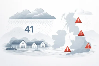
The arrival of the 24°C heat is merely the "calm before the storm," as the Met Office warns of a definitive end to the dry spell late on Friday evening. A volatile low-pressure system is currently gathering strength over the Atlantic and is expected to collide with the warm air mass sitting over the UK, triggering significant rainfall and potential gale-force winds.
This transition is not merely a change in temperature but a complete shift in the atmospheric regime, moving from stable high-pressure conditions to a much more "unsettled" pattern. For many, the transition will be abrupt, with Friday's sunny afternoon giving way to a Saturday morning defined by heavy, persistent rain moving in from the west. This creates a high risk for localized flooding in areas where the ground remains saturated from earlier spring rains.
2026 Weather Progression and System Analysis:
| Day | Primary Weather System | Impact Level | Forecasted Conditions |
| Monday | Northern Frontal Rain | Moderate | Rain pushing south; 22°C in London. |
| Tuesday | Residual Cloud Cover | Low | Grey start, clearing for late sun in the South. |
| Wednesday | High-Pressure Ridge | Low | Dry, bright, and increasingly warm. |
| Thursday | Thermal Build-up | Moderate | Warmest for most; 22°C in Wales/Midlands. |
| Friday | Peak Heat then Cold Front | High | 24°C peak followed by late-night storms. |
| Sat - Sun | Low-Pressure Trough | High | Heavy rain, wind, and significantly cooler air. |
Practical Advice for Navigating the UK’s Volatile Week
With a temperature swing of nearly 15°C expected between Friday afternoon and Saturday morning, residents are advised to adopt a highly flexible approach to their daily routines. The 24°C peak offers a prime opportunity for "vitamin D loading," but health experts warn that the sudden heat can be taxing for vulnerable groups, especially as the humidity rises ahead of the storms.
Additionally, the transition to heavy rain on the weekend means that Friday evening commuters should be prepared for deteriorating road conditions and potential delays on rail networks due to lightning risks. For those in the agricultural sector, the dry window between Wednesday and Friday is critical for fieldwork before the Saturday washout prevents further activity.
Actionable Recommendations for the Week:
- Hydration and Sun Safety: Despite it being April, 24°C with high UV levels requires sunscreen and increased water intake during afternoon peaks.
- Home Management: Keep windows closed during the hottest part of Friday to trap cooler air, but prepare to secure garden furniture by Friday evening.
- Travel Planning: Aim to complete long-distance journeys before Friday sunset to avoid the most intense frontal rain.
- Clothing Strategy: Layers are essential; the "feels like" temperature will drop sharply as the wind picks up on Friday night.
- Flood Prevention: Clear gutters and drains mid-week to handle the high volume of water expected on Saturday.
- Pet Care: Ensure animals have shaded areas during the mid-week warmth, as they may not yet be acclimated to 20°C+ temperatures.
Impact on Business, Agriculture, and the 2026 Economic Outlook
The fluctuating weather patterns of 2026 have already begun to impact the UK's retail and hospitality sectors, and this week is no exception. The 24°C "heat spike" is expected to trigger a surge in consumer spending on outdoor dining and spring apparel, providing a temporary boost to the high street. However, the subsequent weekend rain traditionally dampens footfall, forcing businesses to rely on mid-week momentum.
In the agricultural sector, the timing is particularly sensitive; the "winter-like" conditions easing on Tuesday allow for the late planting of certain crops, but the threat of gales and heavy downpours by Saturday poses a risk to young seedlings. Economically, these sharp transitions require robust logistics and supply chain flexibility to meet the rapid shifts in consumer demand.
Economic and Social Consequences of the Forecast:
- Hospitality Surge: Pub gardens and cafes in the South are expected to see record mid-week bookings for April.
- Energy Consumption: A temporary drop in heating demand will be offset by the potential use of cooling systems in modern office buildings.
- Transport Risks: Heavy rain following a dry spell can make roads particularly greasy due to oil buildup, increasing the risk of accidents.
- Retail Shifts: High demand for barbecue supplies and garden products followed by a sharp pivot to indoor entertainment options.
- Health Services: A slight increase in hay fever reports is expected as the warmth triggers a release of birch and ash pollen.
Frequently Asked Questions
Why is it getting so hot just before it rains?
This is often caused by "thermal drawing," where a developing low-pressure system to the west pulls warm air up from the south (often from the Continent or even North Africa) ahead of its cold front.
Will the 24°C heat return after the weekend?
Current long-range forecasts from the Met Office suggest that conditions will remain "changeable" through early May, with systems of low pressure becoming more likely, meaning a sustained heatwave is improbable.
Is 24°C unusual for late April in the UK?
While not record-breaking, it is significantly above the average of 13-15°C. In 2026, we are seeing more frequent "extreme" swings between cold and warm air masses.
Which part of the UK will be the coldest this week?
Northern Scotland and the Shetland Isles will likely remain the coldest, with temperatures hovering near 8°C and persistent cloud cover throughout the week.
What is the risk of thunderstorms on Friday?
The Met Office indicates a moderate risk as the cold front clashes with the warm, humid air. This can lead to localized "convective" storms, particularly in central and eastern England.
Read about the life of Westminster and Pimlico district, London and the world. 24/7 news with fresh and useful updates on culture, business, technology and city life: US Air Force Fairford fire: Major blaze contained at British base used for Iran operations