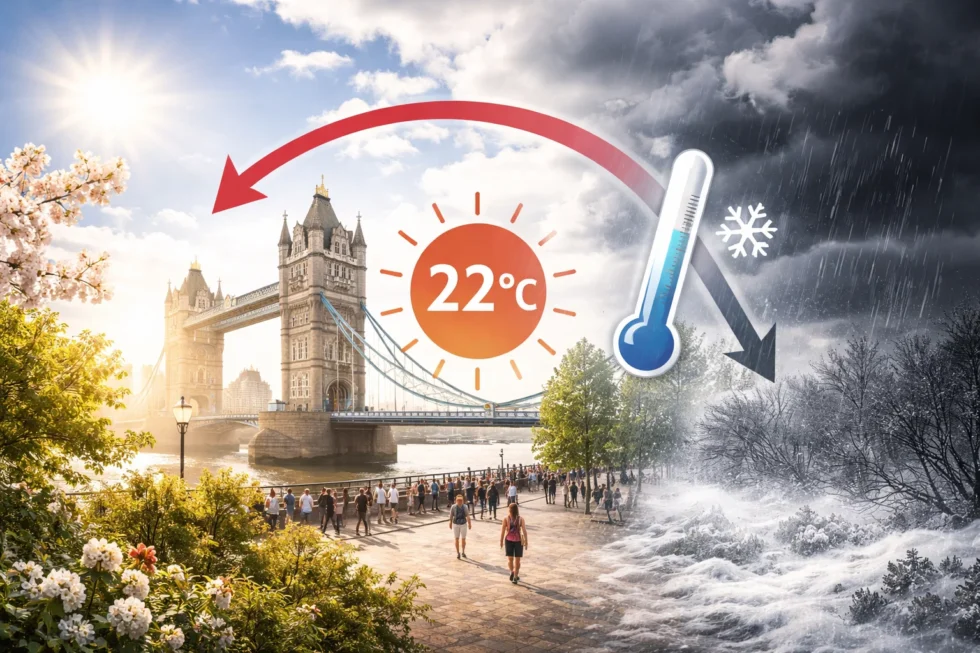
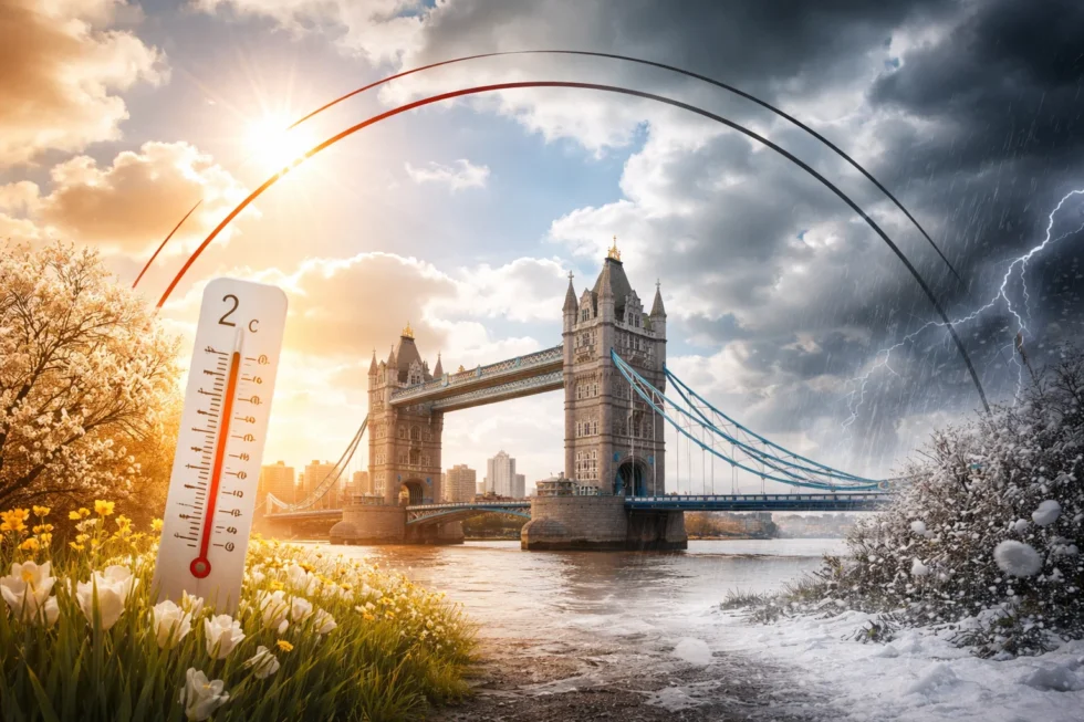
Weather tomorrow 8 April in London and Britain is defined by a short, high-impact warm surge lifting temperatures to 20–22°C in London and up to 24°C across the South East of England, placing parts of the UK well above seasonal norms, before a rapid and measurable cooling trend sets in later this week. A temporary shift to southerly airflow — following the departure of Storm Dave — allows warmer continental air to spread across southern Britain, while areas further north remain cooler at 12–18°C. This pattern is reinforced by a ridge of high pressure, delivering a brief period of settled and largely sunny conditions, according to the Met Office. However, this window is expected to last just 24 to 48 hours, before a change in wind direction draws in cooler Atlantic air, bringing temperatures back down to around 10–14°C and returning the UK to a more typical early-spring pattern of variability, reports The WP Times citing Met Office.
Weather tomorrow 8 April in London and Britain: detailed London forecast
Weather tomorrow 8 April in London and Britain places the capital firmly within the warmest pocket of the country, with conditions briefly resembling late spring rather than early April. In practical terms, Londoners can expect a notably mild and settled day, shaped by a southerly airflow drawing in warmer continental air following the departure of Storm Dave, as indicated by the Met Office.
Temperatures are forecast to reach between 20°C and 22°C across central London, with slightly lower values in outer boroughs. Early cloud will gradually clear, giving way to extended spells of sunshine through the late morning and afternoon. Winds will remain light and predominantly southerly, helping to sustain warmth and maintain overall stability in the lower atmosphere.Humidity is expected to remain moderate, visibility will be good to excellent, and the likelihood of rain is negligible throughout the day. Into the evening, conditions stay unusually mild, with temperatures holding between 12°C and 14°C — well above what would typically be expected for early April in the capital. Key forecast points:
- Temperature: 20–22°C
- Sky: Largely sunny after early cloud
- Wind: Light, southerly
- Rain: Very unlikely
- Evening: Mild, settled and dry
Taken together, this places 8 April among the warmest days of 2026 so far in London, albeit within a narrow and short-lived window.
Weather tomorrow 8 April in London and Britain: UK regional breakdown
Weather tomorrow 8 April in London and Britain will show a clear and structured temperature gradient, with southern areas benefiting most from the warm air mass, while northern regions remain closer to seasonal norms.
| Region | Temperature | Conditions | Interpretation |
|---|---|---|---|
| London & South East | 20–24°C | Sunny, settled | Peak warmth |
| Midlands | 18–21°C | Bright spells | Transitional zone |
| North England | 15–18°C | Variable cloud | Cooler edge |
| Wales | 15–19°C | Sunny intervals | Improving conditions |
| Scotland | 12–16°C | Mixed cloud | Residual instability |
What this means in practice:
- Southern Britain briefly aligns with warmer continental conditions
- Northern areas retain a more typical early-spring feel
- The UK effectively operates under two overlapping weather regimes
Why weather tomorrow 8 April in London and Britain turns unusually warm
Weather tomorrow 8 April in London and Britain is driven by a short-term but well-defined atmospheric configuration rather than any lasting seasonal shift. Following the exit of Storm Dave, a ridge of high pressure builds across the UK. This allows southerly winds to transport warm air from mainland Europe into southern Britain.
At the same time:
- Cloud cover diminishes, increasing solar input
- Ground surfaces warm quickly after recent rainfall
- Light winds reduce heat dispersion
According to the Met Office, wind direction is the primary driver of temperature variability at this time of year.
Core drivers:
- Southerly airflow from continental Europe
- High-pressure stabilisation
- Increased sunshine
- Limited wind mixing
Record-level potential: how close Britain gets
Weather tomorrow 8 April in London and Britain brings temperatures close to the upper range of historical early-April values.
- Forecast peak: around 24°C in the South East
- Early April record: 25°C (2011 and 2020)
- Margin: approximately 1°C
This suggests:
- The warmest day of the year may be set or matched
- Conditions are notably warm but not unprecedented
- The event sits within the upper band of expected variability
The reversal: why temperatures drop after midweek
Weather tomorrow 8 April in London and Britain represents the peak of the current warm phase before a rapid transition. From Thursday onwards:
- Wind direction shifts towards the west or north-west
- Atlantic weather fronts reintroduce cloud and rain
- Atmospheric pressure weakens
Outcome:
- Temperatures fall to 10–14°C
- Conditions become more unsettled
- Wind speeds increase, particularly in exposed areas
By the weekend, the UK returns to a more typical early-spring pattern.
Weather tomorrow 8 April in London and Britain: day-by-day outlook
Weather tomorrow 8 April in London and Britain follows a clearly defined short-term cycle, where a brief period of unusually warm and settled conditions is quickly replaced by cooler, more unstable Atlantic-driven weather. This day-by-day breakdown shows not only temperature changes, but how quickly conditions shift across the UK within the same week.
| Date | Temperature | Conditions | Practical impact |
|---|---|---|---|
| Tue 8 Apr | 20–22°C (London), up to 23°C SE | Sunny, settled | Best day for outdoor activity |
| Wed 9 Apr | 22–24°C (SE England) | Very warm, sunny | Peak of the warm spell |
| Thu 10 Apr | 13–16°C | Increasing cloud, rain spreading from west | Clear transition begins |
| Fri 11 Apr | 11–14°C | Showers, breezy | Noticeable cooling |
| Sat 12 Apr | 9–12°C | Windy, unsettled | Back to typical April conditions |
Pollen levels and health impact across Britain
Weather tomorrow 8 April in London and Britain also marks a turning point in seasonal health conditions, as rising temperatures and dry air significantly increase pollen activity across much of the country. This is one of the first noticeable spikes of the year and may affect daily comfort even during otherwise pleasant weather.
Areas most affected:
- England (especially South East and Midlands)
- Wales
- Southern Scotland
Primary triggers:
- Birch pollen (dominant in April)
- Alder pollen
- Early grass pollen beginning to emerge
Health impact to expect:
- Increased hay fever symptoms
- Eye irritation and reduced concentration
- Discomfort during prolonged outdoor exposure
Practical advice:
- Limit outdoor activity during peak pollen hours (12:00–18:00)
- Use antihistamines where appropriate
- Keep windows closed overnight
- Wear sunglasses outdoors to reduce exposure
When spring actually begins in Britain — and why 8 April doesn’t mark the turning point
Weather tomorrow 8 April in London and Britain may suggest that spring has finally arrived — with temperatures climbing above 20°C and long spells of sunshine — but this is not yet reflected in stable, sustained conditions across the UK. In British terms, spring is not defined by a single warm day, but by reliability: a sequence of milder days, fewer sharp drops in temperature, and a noticeable reduction in day-to-day volatility. That shift typically does not take hold until later in April.
Key reference points — explained in practical terms:
- Meteorological spring begins on 1 March, but often still feels like late winter
- Astronomical spring begins around 20 March, marked by longer daylight rather than stable warmth
- Practical spring — when conditions settle — usually arrives mid to late April
So while 8 April delivers a convincing impression of spring, it remains part of a transitional phase rather than a seasonal shift.
Why spring still hasn’t settled in Britain
Weather tomorrow 8 April in London and Britain sits within a broader atmospheric pattern that remains unsettled, even during warm spells. The UK’s location between the Atlantic Ocean and continental Europe means it is constantly exposed to competing air masses.
Why the delay persists:
- The Atlantic continues to push in cooler, more unstable air
- Sea temperatures remain relatively low after winter
- The jet stream is still active, allowing rapid changes in weather patterns
As a result, warm air can arrive quickly — but struggles to hold its position.
What this week actually shows — a classic early-spring pattern in Britain is not simply a warm spell followed by cooler weather, but a compressed and highly readable example of how the UK atmosphere behaves at this point in the year. Weather tomorrow 8 April in London and Britain sits at the peak of this cycle. A southerly airflow — established after the passage of Storm Dave and confirmed by the Met Office — pulls in warm continental air, lifting temperatures rapidly into the low twenties across London and the South East. At the same time, reduced cloud cover allows stronger April sunshine to reach the surface, amplifying the effect and creating conditions that feel closer to late spring than early April.
However, the key point is not the warmth itself, but its duration. The same setup that enables the temperature spike is inherently unstable. As pressure patterns shift and wind direction turns westerly, the UK reconnects with the Atlantic system, bringing in cooler air, increased cloud and a higher likelihood of rain. This transition can occur within 48 to 72 hours, which is why forecasts show a drop from above 20°C to near 10–14°C by the end of the week. In practical terms, this means that weather tomorrow 8 April in London and Britain should be understood as a peak moment within a fast-moving cycle, not the start of a sustained trend. Warmth arrives quickly, stabilises briefly, and then breaks down just as rapidly. For residents, commuters and visitors, the implication is clear: short windows of favourable weather need to be used immediately, while expectations for continuity should remain cautious.
This pattern — rapid warming, brief stability, and equally rapid cooling — is not unusual for April in Britain. What makes this week notable is the clarity with which the cycle is visible, offering a near textbook example of how British spring operates before it eventually settles later in the month.
Read about the life of Westminster and Pimlico district, London and the world. 24/7 news with fresh and useful updates on culture, business, technology and city life: UK three-day week 2027: when 2027 bank holidays UK create a 10-day break