UK weather today, Friday 17 April 2026, settles into a more usable spring pattern across much of Britain, with London and the South East calmer, drier and slightly warmer than earlier in the week. Temperatures in the capital rise from around 10°C in the morning to 17–18°C later, with cloud dominating early before brighter intervals develop. The key change is the weakening of repeated shower activity, making the day more predictable and easier to plan. The WP Times reports that Met Office guidance highlights a transition phase, where instability eases but does not fully disappear.
Across Britain, the defining feature is now a north–south divide, with southern England benefiting from longer dry spells and lighter winds, while northern and western regions remain more exposed to showers and gusts. There are no storms, no severe weather warnings and no prolonged rainfall systems, but variability remains in exposed areas. This creates a day that is operationally manageable rather than disruptive. The overall pattern supports travel and outdoor activity, especially in the south.
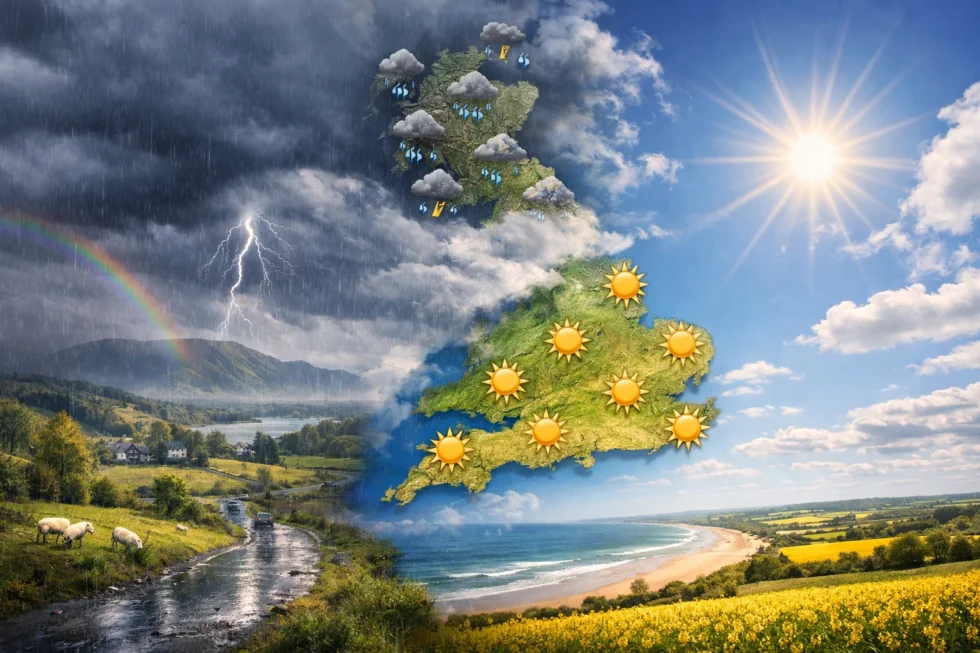
UK-wide outlook: what actually happens across Britain today
Across the UK, conditions are shaped by a weakening Atlantic system, producing a structured but uneven pattern. Southern regions remain mostly dry with occasional brighter spells, while central areas experience mixed cloud and intermittent showers. Northern and western regions see more persistent cloud cover and higher shower frequency, though rainfall remains short-lived rather than continuous. Overall, this is a balanced spring setup, where conditions vary by region but do not escalate into severe weather.
| Region | Conditions | Temp | Wind | Rain risk |
|---|---|---|---|---|
| London & South East | Mostly cloudy → brighter later | 16–18°C | 10–20 km/h | Low |
| South West | Cloudy with sunny breaks | 14–16°C | 15–25 km/h | Low–moderate |
| Midlands | Mixed cloud, some showers | 14–16°C | 15–25 km/h | Moderate |
| North England | Showers early, brighter later | 13–15°C | 20–30 km/h | Moderate |
| Scotland | Cloud, scattered showers | 10–13°C | 25–35 km/h | Higher |
| Wales | Passing rain bands | 11–14°C | 20–30 km/h | Moderate |
| Northern Ireland | Showers, improving later | 11–14°C | 20–30 km/h | Moderate |
London focus: why today is better than it looks
London remains under significant cloud cover for much of the day, but the absence of organised rainfall is the key improvement. Any showers are isolated and brief, allowing long dry intervals that make the day more usable than it appears at first glance. Temperatures reach 17–18°C, and lighter winds reduce the overall chill compared to previous days. The result is a stable, mild spring day that supports normal city activity without weather disruption.
Wind and air: why it feels less cold
The airflow has shifted decisively into a true westerly Atlantic stream, but without the sharper, unstable mixing seen earlier in the week. This brings milder, moisture-balanced maritime air, which smooths out temperature swings and prevents the sudden cold drops typically felt after showers. Wind speeds remain moderate overall, but the structure of the wind is more even, meaning fewer abrupt gusts inland — especially across London and the South East.
A key feature today is the reduced wind chill effect. Earlier in the week, north-westerly flow combined with gustiness amplified cooling after rain; now, with a more stable westerly profile, that effect is weaker. As a result, 16–18°C actually feels like 16–18°C, rather than 13–14°C in exposed conditions. Urban areas such as London benefit further from heat retention and shelter from wind corridors, making the day feel softer and more comfortable despite cloud cover.
Another important factor is lower post-shower cooling and less evaporative chill, meaning even when brief showers occur elsewhere in the UK, the air recovers more quickly. The overall impression is a more balanced, less aggressive spring airflow, where conditions feel calmer, milder and easier to tolerate across most regions.
Rain timing and real risk today
Rainfall today is fragmented and timing-specific, rather than driven by any organised фронт or system. The key feature is that showers develop in isolated pockets, mainly across central, northern and western regions, while much of southern England — especially London — remains largely dry throughout the day. Where rain does occur, it tends to be light to moderate, short-lived and fast-moving, typically lasting 20–40 minutes before clearing.

The highest probability window for showers sits between late morning and early afternoon (10:30–14:30), particularly across the Midlands, northern England and western zones such as Wales. Outside of this window, conditions stabilise, and the likelihood of rain drops significantly, especially into the late afternoon and evening. Importantly, there is no sustained rainfall phase, meaning disruption is limited and local rather than widespread.
Another key detail is the low accumulation factor — even where showers pass through, total rainfall remains minimal, with no risk of flooding, standing water or travel impact. In practical terms, rain today behaves as a brief interruption rather than a structural weather feature, allowing most plans to continue with only minor timing adjustments rather than full changes.
Sunrise, sunset and daylight window
Daylight continues to extend across the UK, significantly improving how the day feels despite cloud cover. Earlier sunrises and later sunsets create more opportunity for conditions to recover after any brief showers. In southern regions, late afternoon brightness becomes more likely, enhancing usability for outdoor plans. This extended daylight is one of the key advantages of mid-April weather.
| Location | Sunrise | Sunset |
|---|---|---|
| London | 06:03 | 19:59 |
| Manchester | 06:07 | 20:11 |
| Edinburgh | 06:04 | 20:21 |
| Cardiff | 06:15 | 20:11 |
| Belfast | 06:19 | 20:29 |
For most of the UK, today is a workable spring day rather than a disruptive one, with the most reliable conditions clearly in southern England, especially London. Travel conditions remain stable across road and rail networks, with no weather-related delays expected, while outdoor activity is entirely realistic if timed around the drier afternoon window. The overall approach is flexibility over avoidance — brief interruptions are possible, but conditions tend to improve rather than deteriorate as the day progresses.
An additional atmospheric detail: the Moon is currently in a waxing gibbous phase, approaching fullness. In traditional British weather folklore, this phase is often linked to “growing light, growing stability”, suggesting that weather patterns gradually become more settled and less erratic compared to earlier transitional days. There is even an old countryside saying: “As the moon grows bright, the winds lose their bite” — a reflection of how conditions today feel softer and less sharp, despite similar temperatures.
Read about the life of Westminster and Pimlico district, London and the world. 24/7 news with fresh and useful updates on culture, business, technology and city life: What is the new East West Rail line and how will it connect Oxford, Milton Keynes, Bedford and Cambridge