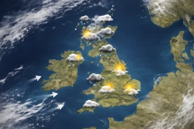
Saturday, 14 February 2026 — Large parts of the UK remain under snow and ice warnings today, with authorities urging the public to take “extra care” as freezing conditions continue to affect roads, pavements and transport networks across the country.
Despite brighter spells in some areas, The WP Times reports, citing the Met Office, that overnight frost combined with lingering snowfall has left many routes hazardous, particularly during the early morning hours. Officials warn that the interaction of icy surfaces, reduced tyre grip and fluctuating visibility is significantly increasing the risk of accidents, especially on untreated or lightly trafficked roads.
Forecasters say Arctic maritime air continues to dominate the current weather pattern, bringing cold conditions that can appear deceptively calm. While periods of sunshine may suggest an improvement, the Met Office stresses that daytime thawing followed by rapid refreezing remains one of the most dangerous factors for both drivers and pedestrians.
UK weather overview — Saturday, 14 February 2026
| Region | Conditions | Temperatures | Warnings in force | Key risks |
|---|---|---|---|---|
| South East England | Cold, bright spells, icy patches | 1°C to 5°C | Yellow ice warning (morning) | Slippery roads, pavements, refreezing |
| London | Dry with sunshine, frost overnight | 2°C to 6°C | Yellow ice warning (early hours) | Black ice on untreated roads |
| South West England | Cold, sunny intervals | 1°C to 6°C | Local ice risk | Early-morning travel hazards |
| Midlands | Cold, dry early, cloud increasing later | 0°C to 4°C | Ice warning, snow later north | Reduced grip, evening deterioration |
| Wales | Cold with sunny spells | 0°C to 5°C | Yellow ice warning | Slips, untreated rural roads |
| North West England | Cloudy, risk of snow later | -1°C to 3°C | Snow and ice warning | Difficult driving, delays |
| North East England | Snow showers, icy conditions | -2°C to 2°C | Snow and ice warning | Snow accumulation, poor visibility |
| Scotland (Lowlands) | Cold, snow at times | -2°C to 2°C | Snow and ice warning | Travel disruption |
| Scotland (Highlands) | Snow, windy at times | -4°C to 0°C | Snow and ice warning | Heavy snow, road closures |
| Northern Ireland | Cold, icy early, dry later | 0°C to 4°C | Ice warning | Slippery surfaces |
A widespread but uneven weather picture
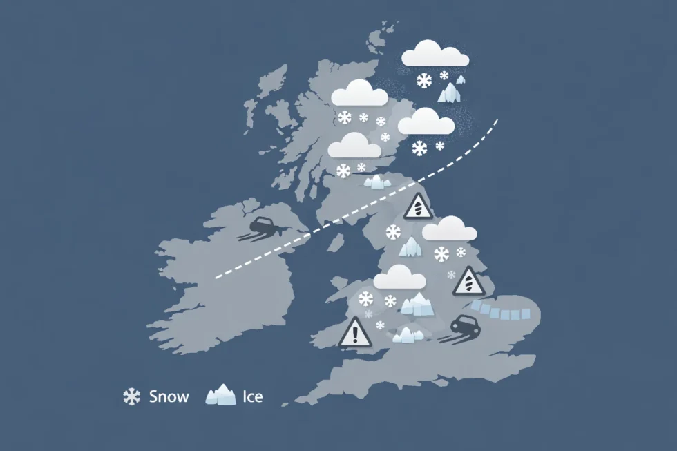
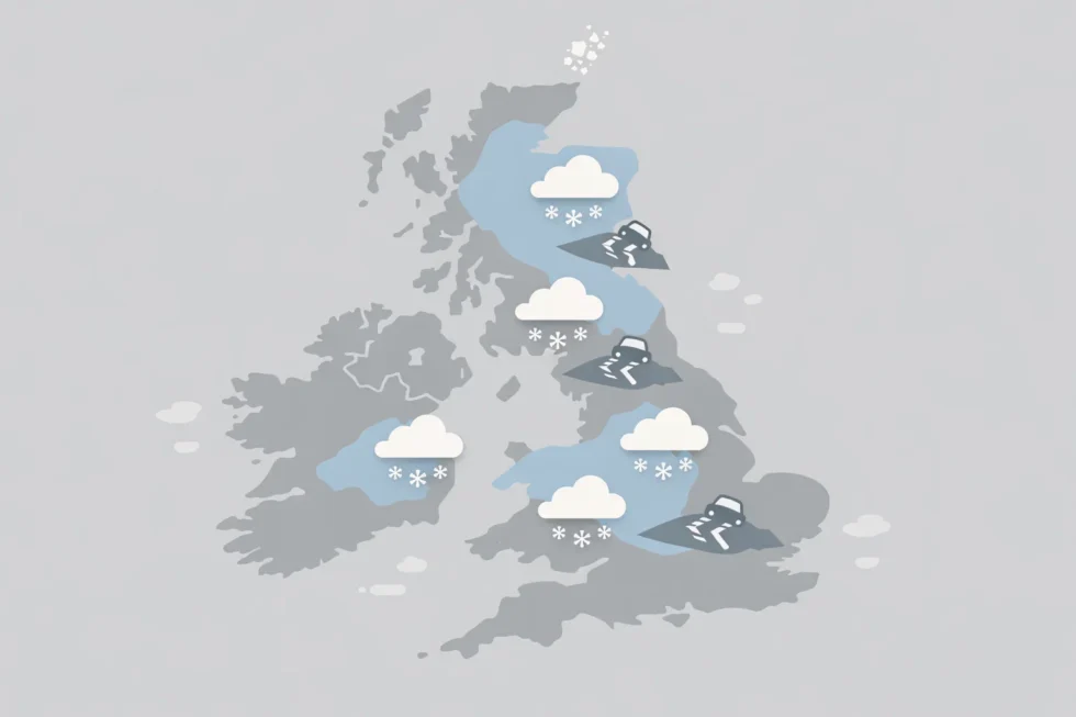
Yellow weather warnings for snow and ice remain in force across much of England, Wales, Scotland and Northern Ireland. In Wales and central and southern England, an ice warning runs from Friday evening into Saturday morning, highlighting the risk of slips, falls and vehicle collisions. Further north, parts of northeast England and northern Scotland remain under snow and ice warnings that began on Friday afternoon. Another yellow warning, stretching from Derby northwards into Scotland, is due to take effect later on Saturday evening and remain in place through Sunday morning. Northern Ireland is also affected, with icy conditions persisting after overnight frosts. In all regions, forecasters emphasise that conditions can vary sharply over short distances, making local awareness essential.
Roads: the biggest concern for authorities
While snowfall totals are relatively modest in some lowland areas, authorities say road conditions remain the most pressing concern. Overnight temperatures below freezing have allowed meltwater to refreeze, creating black ice that is difficult to see and particularly dangerous at junctions, roundabouts and on bridges. National Highways and local councils report that main routes have largely been treated, but secondary roads, residential streets and rural lanes remain patchy. Shaded stretches, steep gradients and exposed routes across higher ground are proving especially problematic.
Police forces in several regions have reported an increase in minor collisions linked to icy roads, while recovery services have warned drivers not to underestimate conditions simply because skies are clear.
Public transport and logistics disruption
Public transport providers are also dealing with knock-on effects. Rail operators have warned of possible delays and short-notice cancellations in northern England and Scotland, particularly on routes that cross higher ground or rely on exposed infrastructure.
Bus operators say services in rural areas may be curtailed if conditions worsen, while airports in Scotland and northern England are monitoring snowfall closely in case runway treatments are required. Logistics firms have also flagged slower deliveries in affected regions, particularly for early-morning routes where ice remains widespread.
Snowfall totals and regional impacts
The Met Office says snow could be “heavy at times” in northern regions. Accumulations of 1–3cm at low levels are possible, rising to 3–7cm above 150 metres, and potentially 10–15cm above 400 metres in parts of northern England and Scotland. Although these amounts are not exceptional by historical standards, officials stress that even small accumulations can cause significant disruption when combined with freezing temperatures and strong winds. Upland routes, including parts of the Pennines and Scottish Highlands, are most at risk of temporary closures or restrictions if conditions deteriorate overnight into Sunday.
What forecasters are warning about next
Met Office chief forecaster Rebekah Hicks said snow is likely ahead of incoming rain across northern England and Scotland, with conditions becoming more unsettled later in the weekend. She warned that snow may reach lower levels at times on Saturday night into Sunday before gradually turning to rain as fronts move eastwards. Coastal areas could also see strengthening winds, increasing the risk of fallen branches and further travel disruption. Forecasters caution that this transition from snow to rain is particularly hazardous, as rain falling on frozen ground can rapidly worsen surface conditions.
Flood risk alongside winter weather
While snow and ice dominate headlines, flood risk remains an ongoing concern following weeks of unsettled weather. The Environment Agency says dozens of flood warnings and more than a hundred flood alerts remain active across England.
Officials report that more than 24,000 homes and businesses have been protected through flood defences, pumping operations and temporary barriers. However, several hundred properties have already experienced flooding, particularly in low-lying areas and near rivers that remain swollen. Emergency teams continue to clear waterways and monitor river levels, while residents in affected areas are urged to remain alert to changing conditions.
Government and agency response
Floods minister Emma Hardy said flooding can be devastating for communities and urged residents to follow local advice over the coming days. She stressed that the combination of winter weather and saturated ground increases the risk of rapid changes in river levels, particularly if heavier rain arrives as forecast. Local authorities say they remain ready to escalate response measures if conditions worsen, including opening rest centres where necessary.
How people are being advised to behave
Authorities are urging the public to adjust behaviour to match conditions rather than relying on appearance alone. Key advice includes:
- Drive more slowly and increase braking distances
- Expect icy patches even on treated main roads
- Take extra care on pavements, especially early in the morning and after dark
- Check weather and travel updates before setting out
- Follow local flood guidance where alerts are in place
Road safety experts stress that many winter accidents occur when drivers assume conditions have improved because roads appear clear. Meteorologists say this weekend highlights a recurring winter pattern: marginal conditions that are not extreme but remain persistently hazardous. These situations often produce more injuries and minor accidents than headline-grabbing snowstorms, precisely because people lower their guard. With temperatures expected to remain low into Sunday and further warnings possible, authorities say caution remains essential. While conditions are expected to gradually improve in some southern areas, northern regions may face further disruption as weather systems move through. For now, the message from forecasters and emergency services is clear: winter hazards remain very much in play, and taking extra care — particularly on the roads — could make the difference between a routine journey and a dangerous one.
Read about the life of Westminster and Pimlico district, London and the world. 24/7 news with fresh and useful updates on culture, business, technology and city life: Why are vitamin D users in the UK warned to stop supplements when these symptoms appear